Uphill
291m
Length
9km
Duration
3h
Elev gain
291m
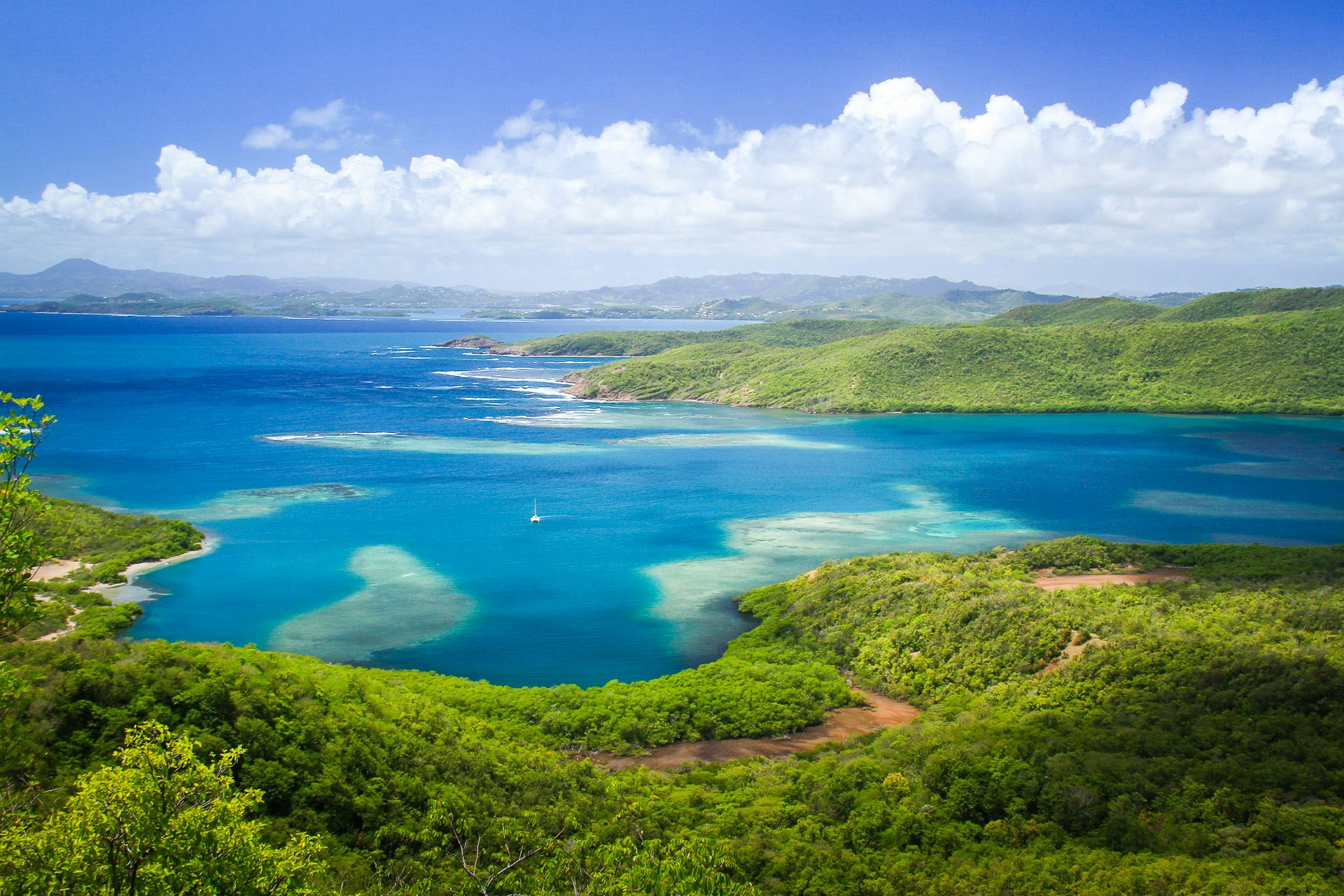
This trail runs through the magnificent Caravelle peninsula, the end of which is a national nature reserve. The landscapes are varied between mangroves, numerous moors, and a steep coast.
Note that in the event of rain, the path can be muddy and you should avoid taking shelter under the Mancellinier trees, which emit a toxic substance.

Already more than 200,000 users!
Uphill
291m
Highest point
137m
Downhill
291m
Lowest point
0m
Route type
Loop
Download the map on your smartphone to save battery and rest assured to always keep access to the route, even without signal.
Includes IGN France and Swisstopo.
I indicate whether dogs are allowed or prohibited on this trail
Difficult after heavy rains
3 ratings
Also enjoy:

Already more than 200,000 users!


