Uphill
812m
Length
9km
Duration
5h30min
Elev gain
812m
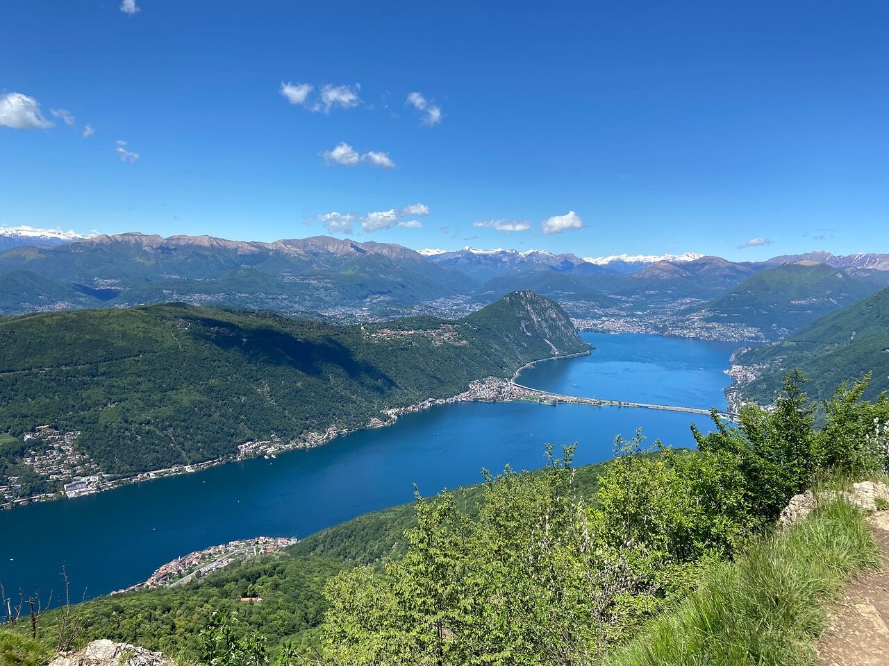
Hike to climb Monte San Giorgio, from Riva San Vitale. The route loops and climbs steeply to Monte San Giorgio, located 1,097 meters above sea level. At the top, the view of Lake Lugano is magnificent, and the efforts made are rewarded.

Already more than 200,000 users!
Uphill
812m
Highest point
1088m
Downhill
812m
Lowest point
274m
Route type
Loop
Download the map on your smartphone to save battery and rest assured to always keep access to the route, even without signal.
Includes IGN France and Swisstopo.
Parking by the side of the road.
Capolago - Riva San Vitale Station nearby.
I indicate whether dogs are allowed or prohibited on this trail
Can be difficult in Winter
0 ratings
Also enjoy:

Already more than 200,000 users!


