Uphill
605m
Length
13km
Duration
5h
Elev gain
605m
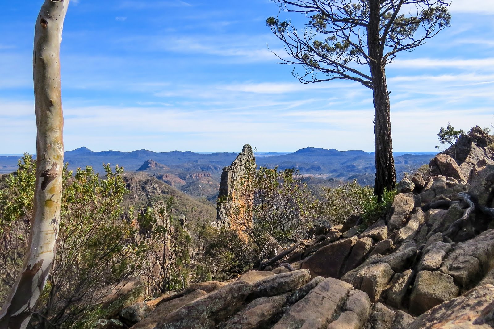
This is a difficult and epic loop to the Breadknife and Grand High Tops in Warrumbungle National Park. The trail combines wide tracks, paved sections, stair passages and steeper inclines. The views throughout the walk are fantastic, opening up on the surrounding peaks and impressive geological formations. There is also an abundant wildlife and chances of spotting wallabies are quite high.

Already more than 200,000 users!
Uphill
605m
Highest point
965m
Downhill
605m
Lowest point
492m
Route type
Loop
Download the map on your smartphone to save battery and rest assured to always keep access to the route, even without signal.
Includes IGN France and Swisstopo.
I indicate whether dogs are allowed or prohibited on this trail
All year
0 ratings
Also enjoy:

Already more than 200,000 users!