Uphill
888m
Length
15km
Duration
6h30min
Elev gain
888m
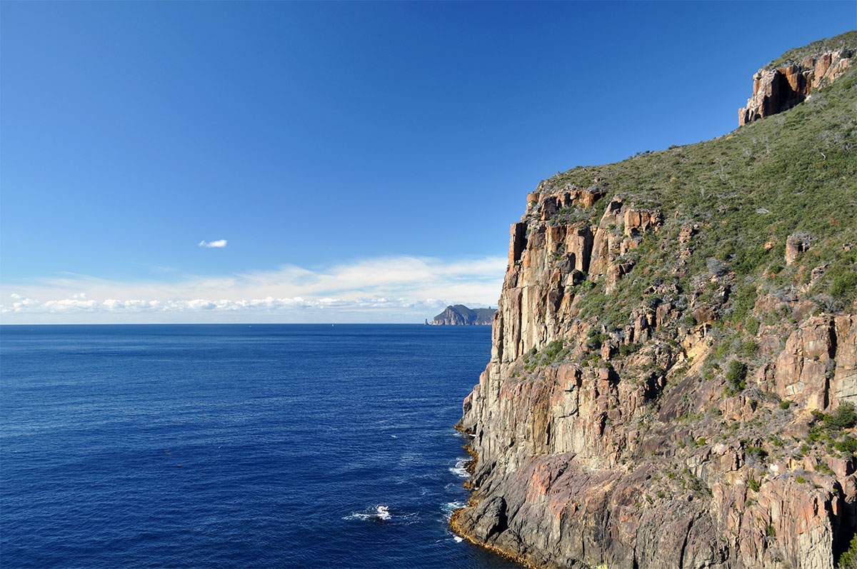
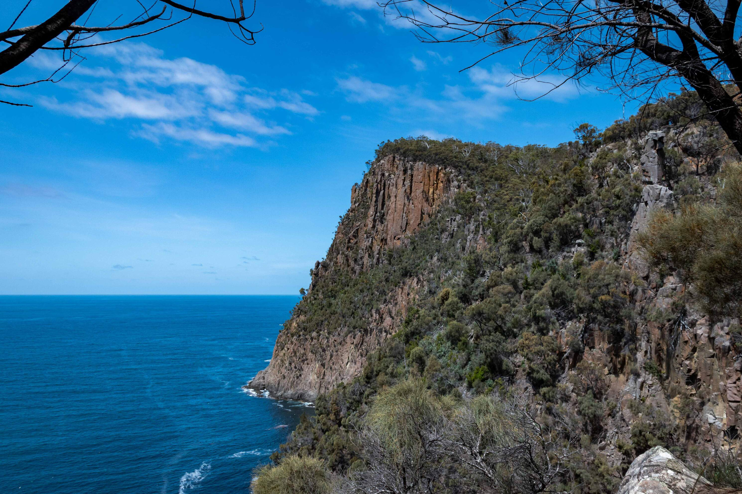
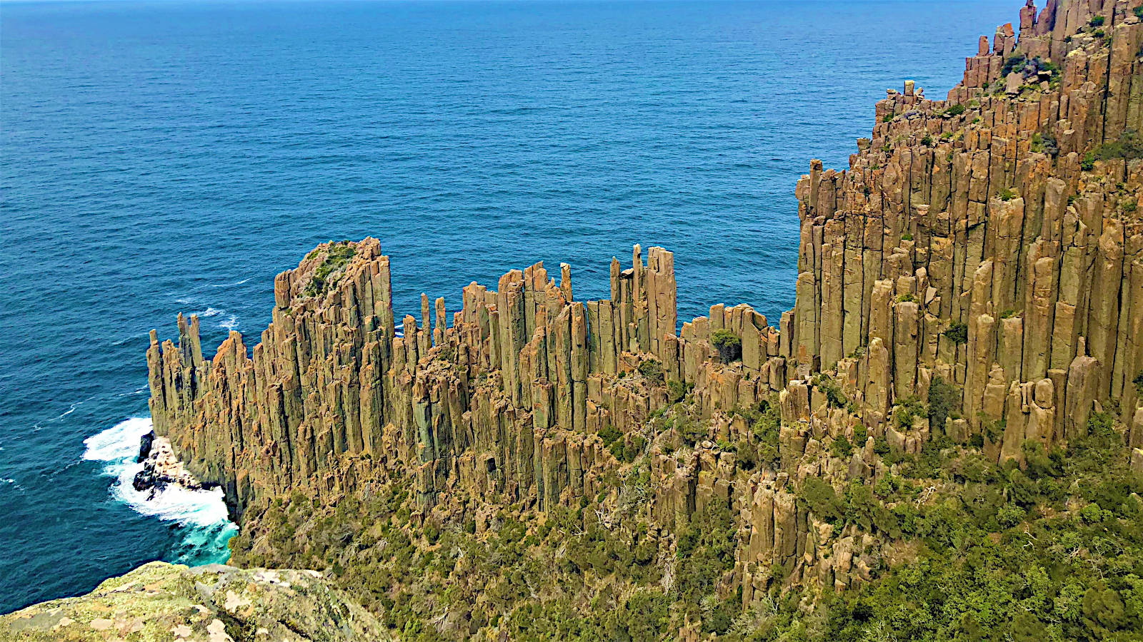
This is an amazing there-and-back trail in Tasman National Park leading to Cape Raoul and its iconic rock formation.
The trail begins under the trees to then open on the cliff edges and follow them to the cape. There are many sections on boardwalks and a few steep sections.
The views are incredibly beautiful with the ocean and the unique rock formation, all the way and the lookout at the end is fantastic. The coastal flora adds to the charm of the walk and there might even be some seals in the water and adjacent islands.

Already more than 200,000 users!
Uphill
888m
Highest point
432m
Downhill
888m
Lowest point
0m
Route type
There and back
Download the map on your smartphone to save battery and rest assured to always keep access to the route, even without signal.
Includes IGN France and Swisstopo.
I indicate whether dogs are allowed or prohibited on this trail
All year
0 ratings
Also enjoy:

Already more than 200,000 users!