Uphill
481m
Length
10km
Duration
4h
Elev gain
481m
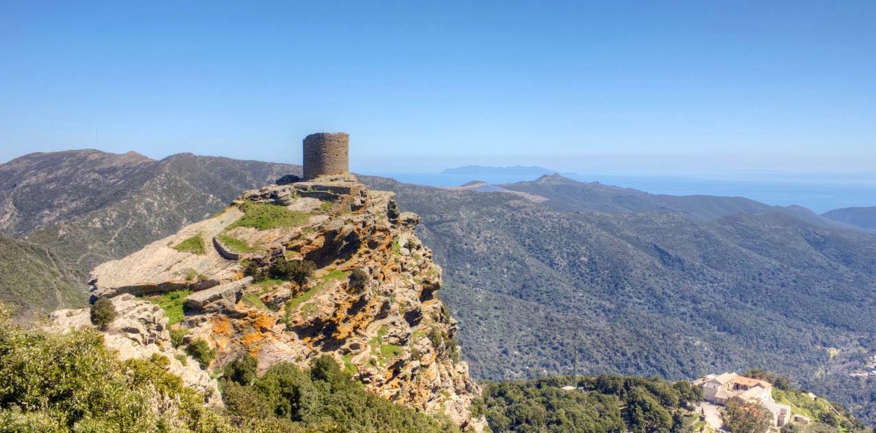
Loop hike to discover the Pinzu menhirs and the Genoese tower of Sénèque. The trail follows crests and offers a magnificent panorama on both sides of Cap Corse.

Already more than 200,000 users!
Uphill
481m
Highest point
812m
Downhill
481m
Lowest point
361m
Route type
Loop
Download the map on your smartphone to save battery and rest assured to always keep access to the route, even without signal.
Includes IGN France and Swisstopo.
I indicate whether dogs are allowed or prohibited on this trail
All year
3 ratings
Balade effectuée dans le sens inverse de celui proposé dans l’appli. La partie vers le tour de Sénèque est à pic, et assez fréquentée.
Le reste est beaucoup plus calme (j’ai croisé un seul randonneur, en mai), et les paysages sont variés. Par mal de maquis si typique de la Corse.
Les panoramas sont exceptionnels ; je voyais clairement jusqu’à Saint-Florent et les montagnes au-delà !
Also enjoy:

Already more than 200,000 users!


