Uphill
1025m
Length
11km
Duration
7h
Elev gain
1025m
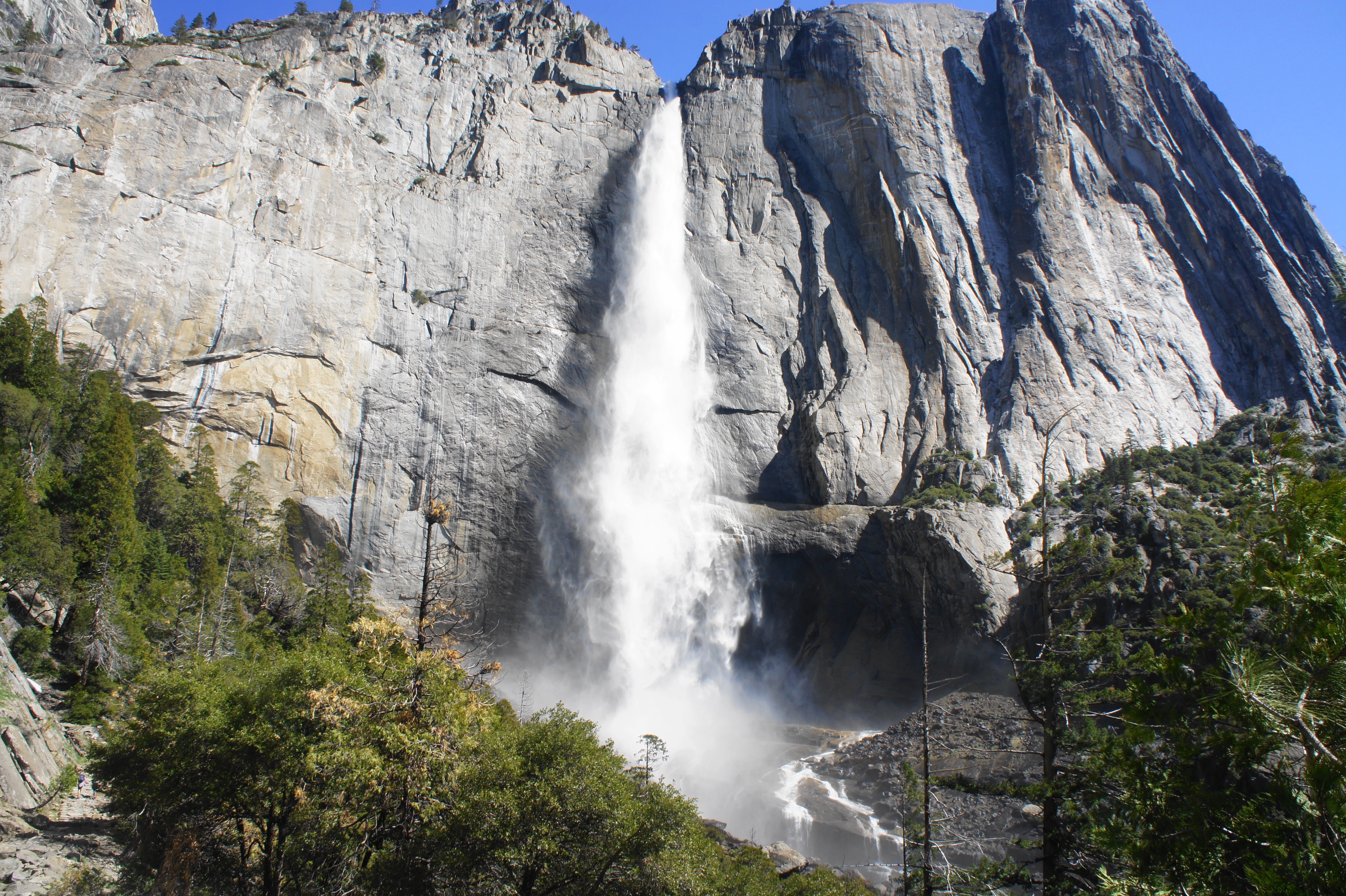
This is a challenging yet incredible there-and-back hike along the Upper Yosemite Fall trail in Yosemite National Park, California. The falls are standing tall with a 739 meters fall into the valley, making it one of the tallest in the world. The climb up is challenging with a steep gradient and a lot of switchbacks particularly in between the lower gate and upper gate before reaching the fall overlook. On the way hikers will be rewarded with the most spectacular landscapes and views including vistas on Half Dome and Sentinel Dome making the hike well worth it.

Already more than 200,000 users!
Uphill
1025m
Highest point
2043m
Downhill
1025m
Lowest point
1216m
Route type
There and back
Download the map on your smartphone to save battery and rest assured to always keep access to the route, even without signal.
Includes IGN France and Swisstopo.
I indicate whether dogs are allowed or prohibited on this trail
All year
0 ratings
Also enjoy:

Already more than 200,000 users!