Uphill
500m
Length
9km
Duration
3h30min
Elev gain
500m
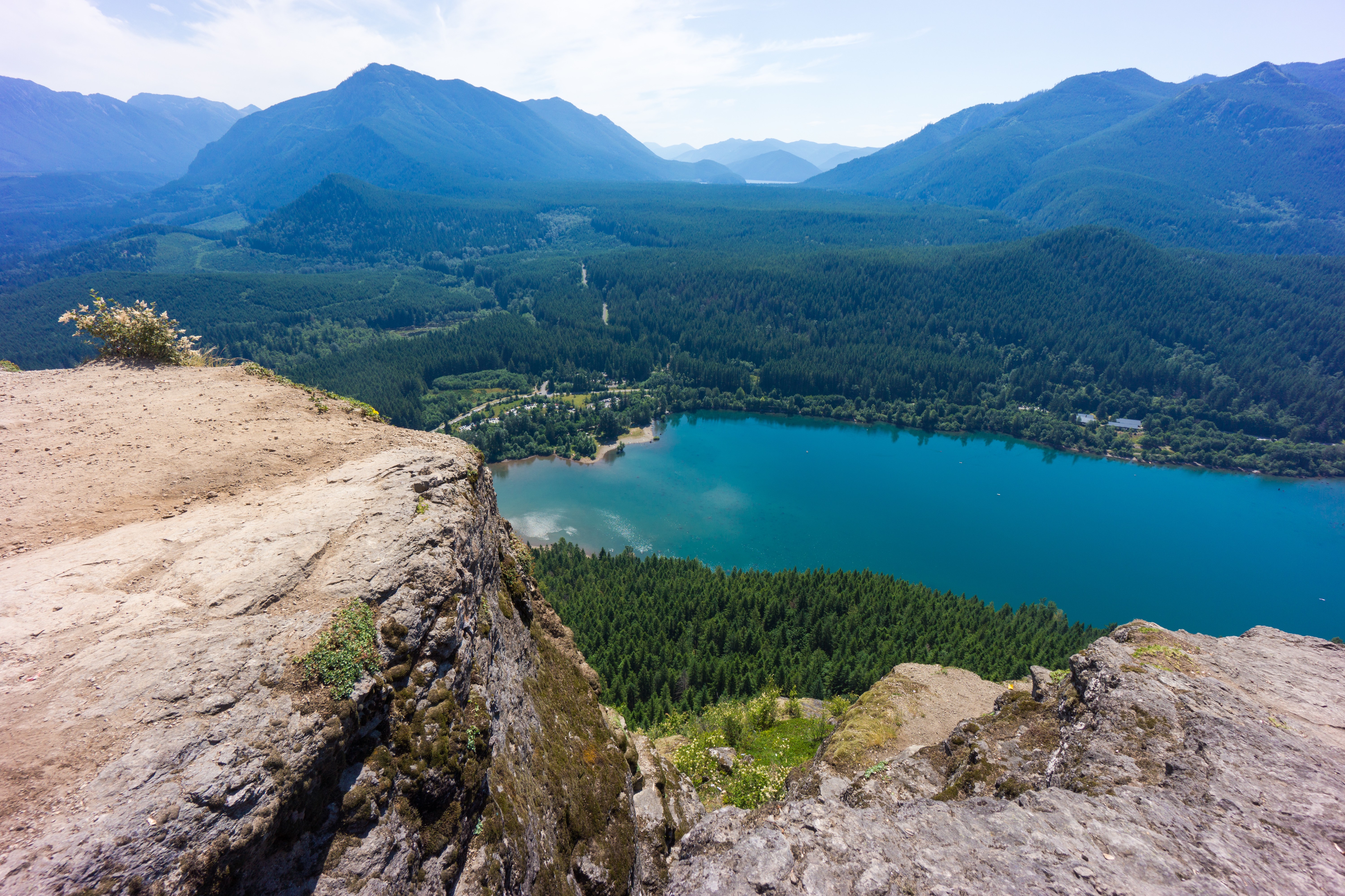
This is a great there-and-back trail along the Rattlesnake Ledges, only a short drive from Seattle, which is a popular summer hike with breathtaking panoramic vistas. This trail is moderate mostly following narrow footpaths under the thick canopy of trees, with a very manageable uphill gradient on the way to the top. Hikers will be rewarded with stunning views from the top of Rattlesnake Ridge. The distant mountains and Rattlesnake Lake in the foreground make the most beautiful scenery!

Already more than 200,000 users!
Uphill
500m
Highest point
712m
Downhill
500m
Lowest point
279m
Route type
There and back
Download the map on your smartphone to save battery and rest assured to always keep access to the route, even without signal.
Includes IGN France and Swisstopo.
I indicate whether dogs are allowed or prohibited on this trail
All year
0 ratings
Also enjoy:

Already more than 200,000 users!