Uphill
110m

Length
9km
Duration
2h30min
Elev gain
110m
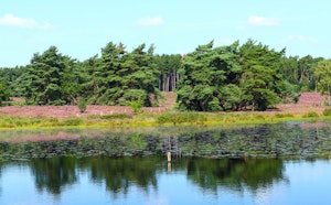
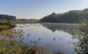
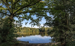
This is a walk through the magnificent Kelchterhoef estate, near Zonhoven. The route makes a loop in a natural and wild environment where calm reigns, between forests, meadows and marshes.

Already more than 200,000 users!
Uphill
110m
Highest point
82m
Downhill
110m
Lowest point
41m
Route type
Loop
Download the map on your smartphone to save battery and rest assured to always keep access to the route, even without signal.
Includes IGN France and Swisstopo.
I indicate whether dogs are allowed or prohibited on this trail
All year
0 ratings
Also enjoy:

Already more than 200,000 users!