Uphill
110m
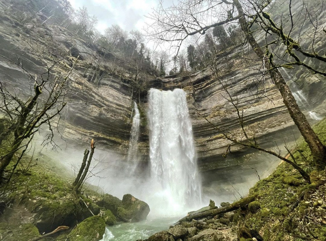
France > Bourgogne-Franche-Comté > Doubs > Doubs Horloger Nature Park
Length
2km
Duration
1h
Elev gain
110m
Departing from Consolation-Maisonnette, the Val de Consolation offers visitors a bewitching atmosphere with its stream and trees covered with moss. But it is the cliffs and waterfalls that make the show, especially the Lançot waterfall and its 47 meters high.

Already more than 200,000 users!
Uphill
110m
Highest point
629m
Downhill
110m
Lowest point
515m
Route type
There and back
Download the map on your smartphone to save battery and rest assured to always keep access to the route, even without signal.
Includes IGN France and Swisstopo.
I indicate whether dogs are allowed or prohibited on this trail
All year
2 ratings
Also enjoy:

Already more than 200,000 users!


