Uphill
32m
Length
8km
Duration
2h
Elev gain
32m
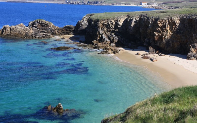
Tour of a small island, which has remained essentially wild. Beaches and rocky headlands follow one another and offer very pretty landscapes.

Already more than 200,000 users!
Uphill
32m
Highest point
17m
Downhill
32m
Lowest point
0m
Route type
Loop
Download the map on your smartphone to save battery and rest assured to always keep access to the route, even without signal.
Includes IGN France and Swisstopo.
Starting from the port of Hoëdic.
Sea shuttles from Vannes, Port-Navalo, Locmariaquer, Le Croisic and La Turballe
I indicate whether dogs are allowed or prohibited on this trail
All year
1 rating
Tour de l’île déjà effectué à deux reprises, on ne s’en lasse pas ! Ce n’est pas si loin de Nantes, et pourtant on se croirait au bout du monde… En dehors du petit bourg au centre de l’île, les paysages sont sauvages, avec une côte escarpée à l’ouest, et de jolies plages à l’ouest.
Also enjoy:

Already more than 200,000 users!


