Uphill
76m
Length
2km
Duration
30min
Elev gain
76m
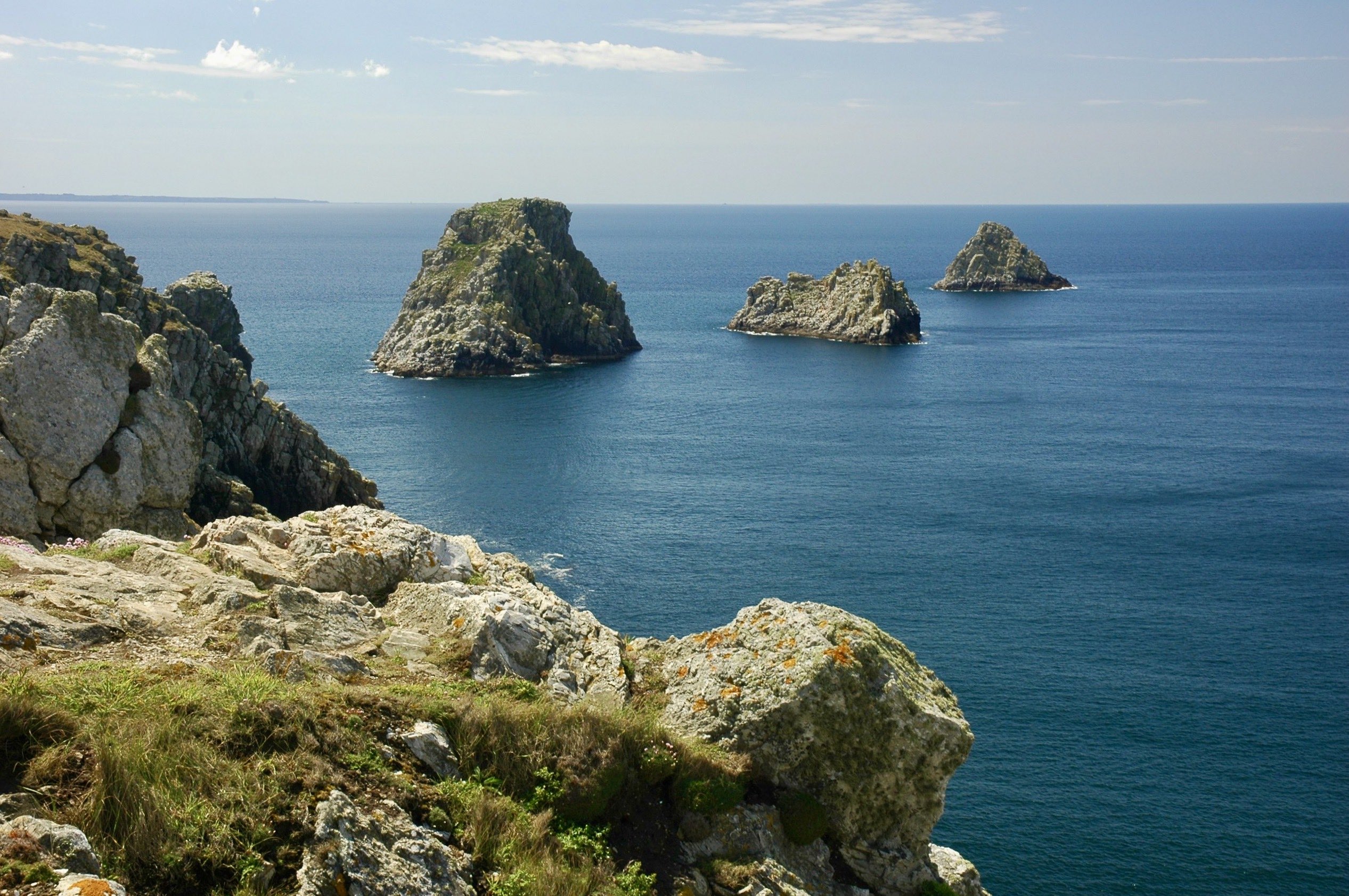
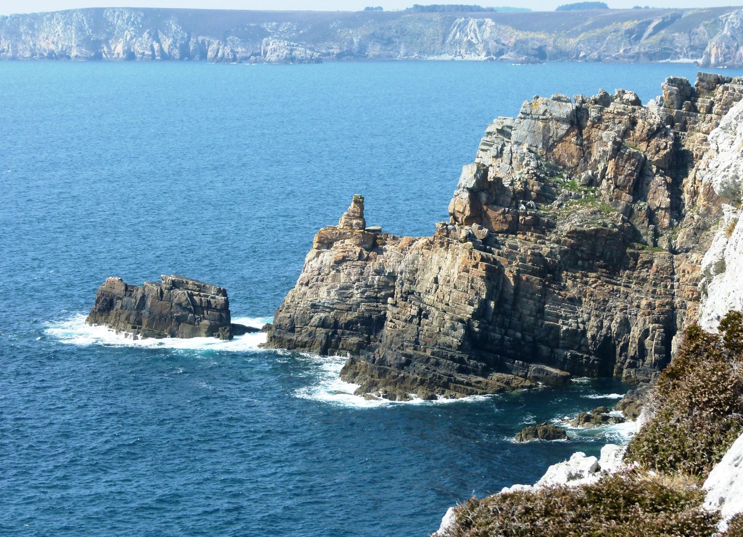
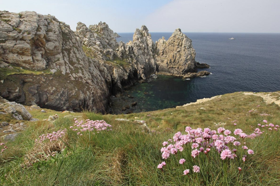
Walk to the tip of Pen Hir, located at the western end of the Crozon peninsula. Its 70-meter-high cliffs offer an exceptional view of the Iroise Sea and the famous Tas de Pois, these rocks scattered offshore.

Already more than 200,000 users!
Uphill
76m
Highest point
62m
Downhill
76m
Lowest point
3m
Route type
Loop
Download the map on your smartphone to save battery and rest assured to always keep access to the route, even without signal.
Includes IGN France and Swisstopo.
I indicate whether dogs are allowed or prohibited on this trail
All year
2 ratings
Facile d’accès et très agréable à faire en famille
Also enjoy:

Already more than 200,000 users!