Uphill
134m

Length
4km
Duration
1h30min
Elev gain
134m
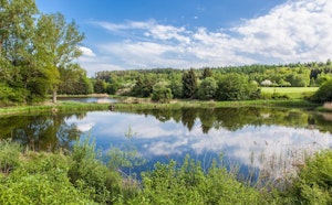
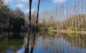
A short stroll around the Pincemaille reservoir, in Rillé. The course goes around the body of water and passes by a small beach, where swimming is allowed.

Already more than 200,000 users!
Uphill
134m
Highest point
131m
Downhill
134m
Lowest point
52m
Route type
Loop
Download the map on your smartphone to save battery and rest assured to always keep access to the route, even without signal.
Includes IGN France and Swisstopo.
I indicate whether dogs are allowed or prohibited on this trail
All year
1 rating
Also enjoy:

Already more than 200,000 users!