Uphill
395m
Length
6km
Duration
3h
Elev gain
395m
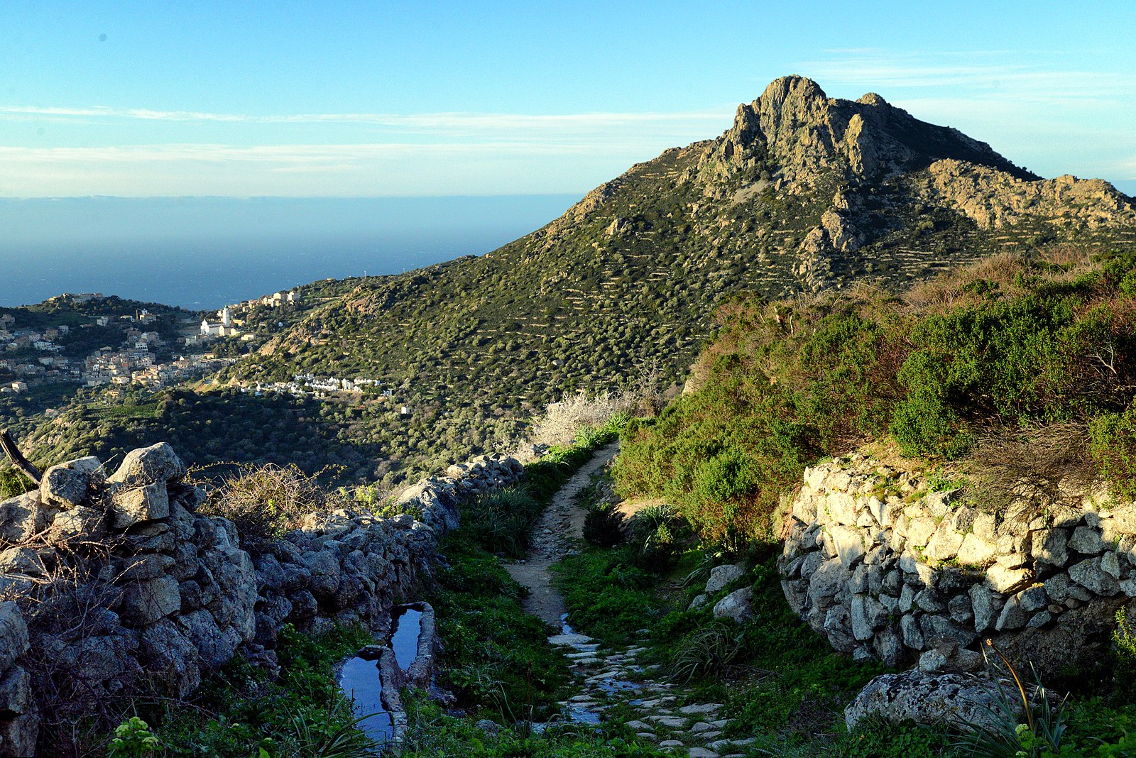
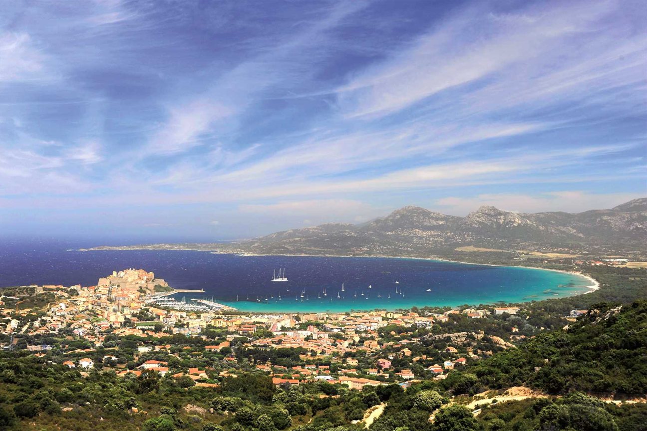
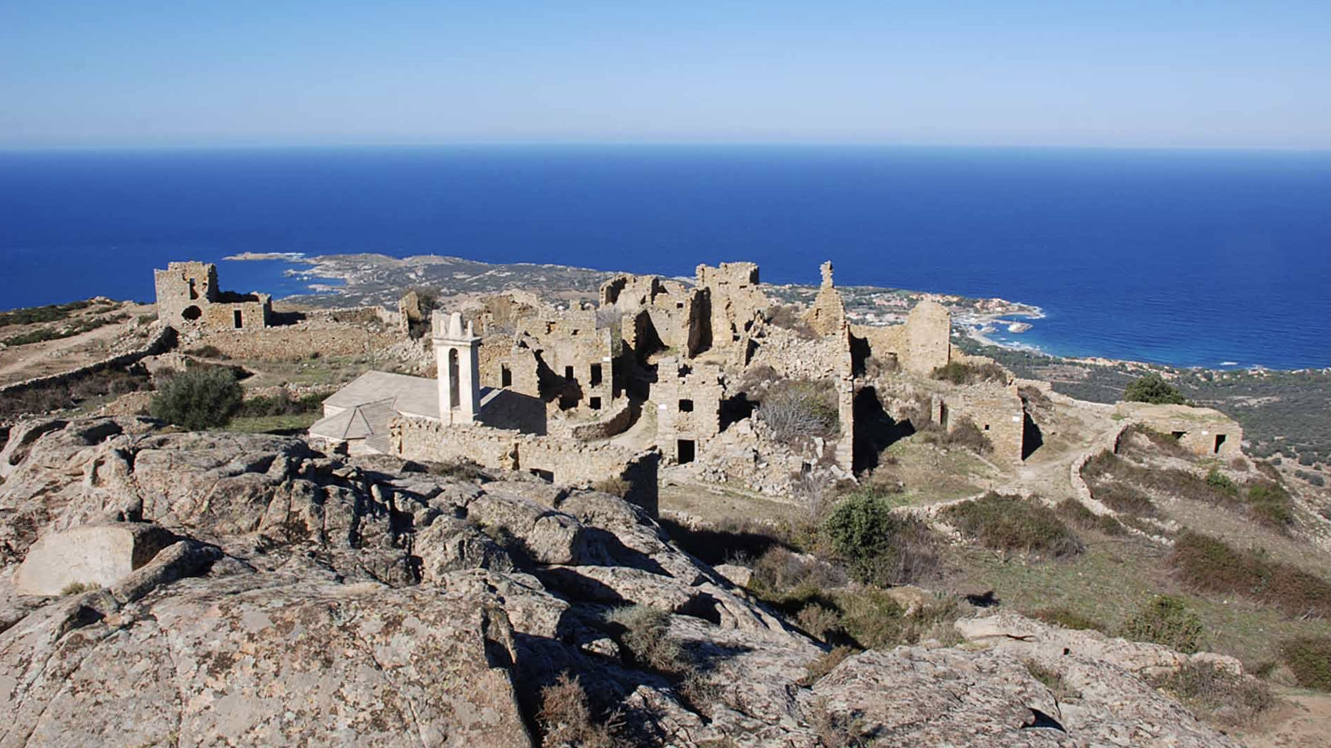
Departing from Lumio, this trail leads to Capu d'Occi (563 m) before discovering the abandoned village of Occi. Nice view of the Balagne and the bay of Calvi.

Already more than 200,000 users!
Uphill
395m
Highest point
570m
Downhill
395m
Lowest point
169m
Route type
Loop
Download the map on your smartphone to save battery and rest assured to always keep access to the route, even without signal.
Includes IGN France and Swisstopo.
I indicate whether dogs are allowed or prohibited on this trail
All year
4 ratings
Also enjoy:

Already more than 200,000 users!