Uphill
1101m

France > Grand Est > Haut-Rhin > Ballons des Vosges Regional Natural Park
Length
12km
Duration
5h
Elev gain
1101m
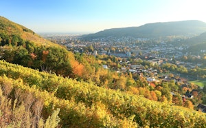
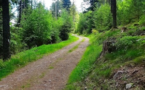
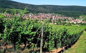
Leaving from Guebwiller, the trail quickly leaves the town to rush into the forest... and it's no joke! With more than 1,000 meters of elevation gain, this stage is the steepest of the trek.
The route goes over the Peternit pass and the rocks of Saint-Pirmin, then arrives at the Judenhut pass, which is a beautiful picnic spot due to the panorama.
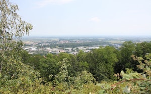
Finally, the path climbs to the Grand Ballon, whose view of the plain of Alsace and the Black Forest rewards the efforts of the day.

Already more than 200,000 users!
Uphill
1101m
Highest point
1349m
Downhill
48m
Lowest point
291m
Route type
One way
Download the map on your smartphone to save battery and rest assured to always keep access to the route, even without signal.
Includes IGN France and Swisstopo.
Several accommodation options around the Grand Ballon. Also possible to bivouac at the Judenhut pass, before the final climb.
I indicate whether dogs are allowed or prohibited on this trail
Can be difficult in Winter
2 ratings
Partie exigeante du trek, avec une bonne partie du dénivelé positif, réalisée en 4h. Le col de Judenhut est arrivé un peu tôt pour déjeuner et encore plus pour bivouaquer. C’est en revanche une bonne solution si vous démarrer ce trek en fin de matinée, début d’après-midi. Un conseil : prévoir de quoi se couvrir des rafales de vent au sommet du Grand Ballon. La vue vient récompenser cette ascension.
Also enjoy:

Already more than 200,000 users!