Uphill
738m

Length
9km
Duration
5h
Elev gain
738m
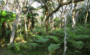
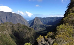
Departing from Hell-Bourg, this hike leads to the Manouilh springs, hot springs discovered by the poacher Lucien Emmanuel Lucilly.

Already more than 200,000 users!
Uphill
738m
Highest point
1489m
Downhill
738m
Lowest point
902m
Route type
Loop
Download the map on your smartphone to save battery and rest assured to always keep access to the route, even without signal.
Includes IGN France and Swisstopo.
I indicate whether dogs are allowed or prohibited on this trail
Difficult after heavy rains
0 ratings
Also enjoy:

Already more than 200,000 users!