Uphill
262m
Length
6km
Duration
2h
Elev gain
262m
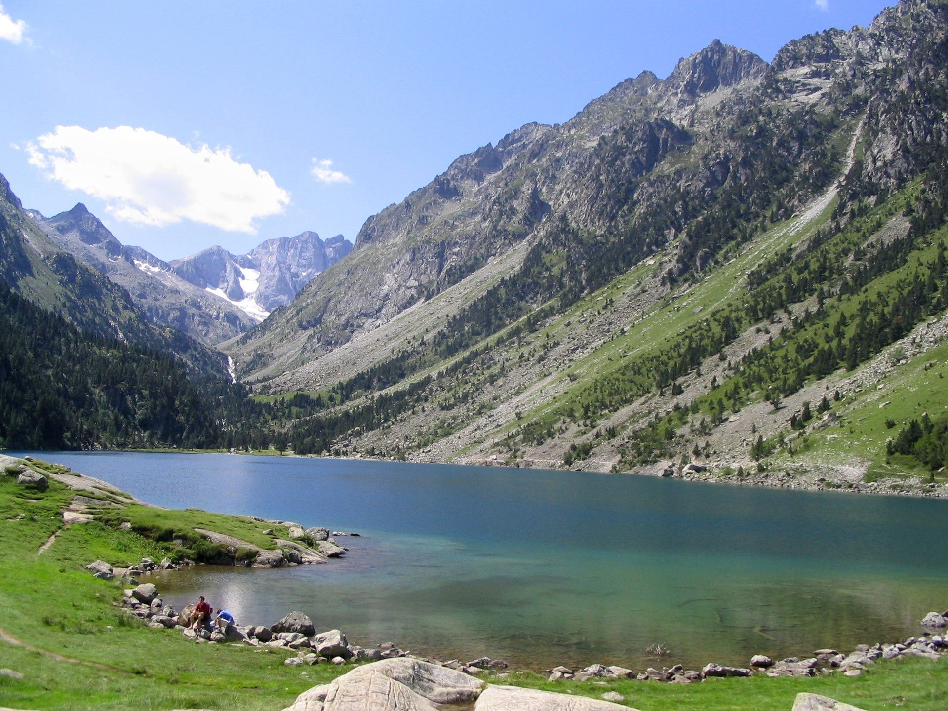
Departing from the Pont d'Espagne, this circuit runs along the Gave de Gaube and its small waterfalls, in order to reach one of the most beautiful lakes in the Pyrenees: the Lac de Gaube. Located in the heart of the Pyrenees National Park, this large natural lake reflects the Vignemale massif.

Already more than 200,000 users!
Uphill
262m
Highest point
1751m
Downhill
262m
Lowest point
1497m
Route type
Loop
Download the map on your smartphone to save battery and rest assured to always keep access to the route, even without signal.
Includes IGN France and Swisstopo.
Parking du Puntas (paid).
A paid ski lift also allows you to reach the lake, for those wishing to shorten the hike.
4 ratings
Supert rando attention GR 10 penser aux chaussures adaptées
Also enjoy:

Already more than 200,000 users!


