Uphill
192m

Length
6km
Duration
2h
Elev gain
192m
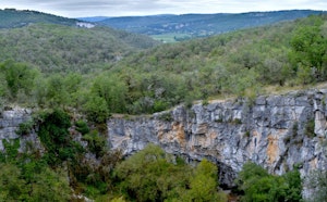
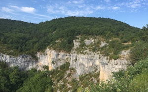
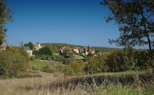
Departing from Saint-Martin-Labouval, this hike rises to offer beautiful views. The route leaves the village built on the banks of the Lot towards the Pic du Renard. Along the way, the views of the meanders of the Lot and the Causses are splendid.

Already more than 200,000 users!
Uphill
192m
Highest point
320m
Downhill
192m
Lowest point
127m
Route type
Loop
Download the map on your smartphone to save battery and rest assured to always keep access to the route, even without signal.
Includes IGN France and Swisstopo.
I indicate whether dogs are allowed or prohibited on this trail
All year
1 rating
A nice hike but part of it is now blocked off by a few electric fences despite being on the official (yellow) hiking route. It’s not exactly difficult to find a way to pass those fences however the possibility of crossing bucks may not exactly inspire confidence.
Also enjoy:

Already more than 200,000 users!