Uphill
681m
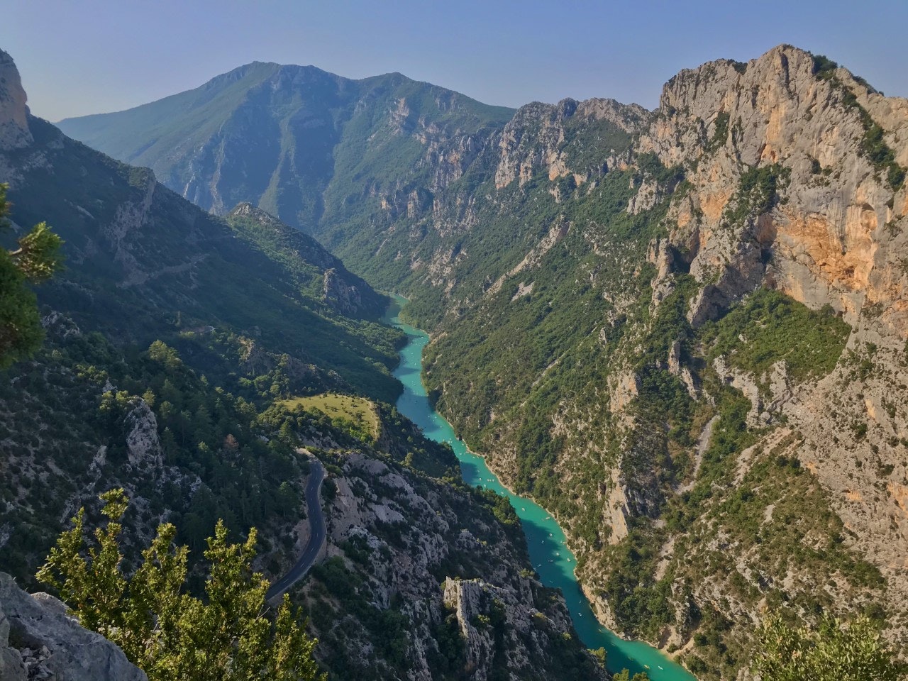
France > Provence-Alpes-Côte d'Azur > Alpes-de-Haute-Provence > Verdon Regional Natural Park
Length
9km
Duration
4h30min
Elev gain
681m
Magnificent hike passing through two passes: the Col de l'Âne and the Col de Plein Voir. On the program: breathtaking views of Lake Sainte-Croix, the Gorges du Verdon and the village of Aiguines.
Be careful, the return has steep slopes as well as aerial passages!

Already more than 200,000 users!
Uphill
681m
Highest point
1188m
Downhill
681m
Lowest point
663m
Route type
Loop
Download the map on your smartphone to save battery and rest assured to always keep access to the route, even without signal.
Includes IGN France and Swisstopo.
I indicate whether dogs are allowed or prohibited on this trail
All year
2 ratings
Also enjoy:

Already more than 200,000 users!


