Uphill
335m
Length
15km
Duration
5h30min
Elev gain
335m
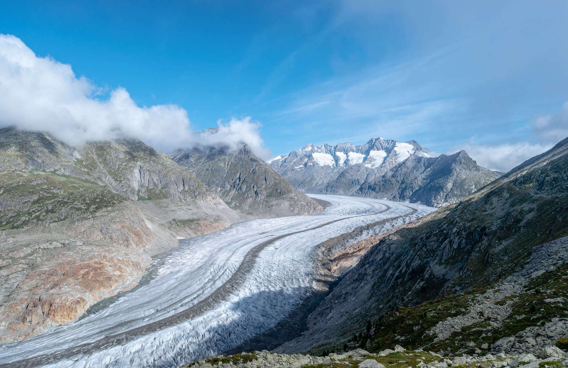
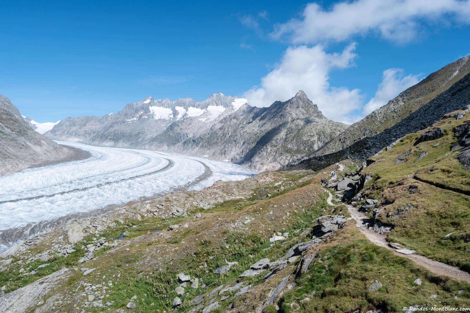
Crossing hike between Bettmerhorn and Bettmeralp. The route descends for the most part and passes through the fantastic Märjelensee. Here, a short break is essential to enjoy the beauty offered by nature. The trail then continues to the village of Bettmeralp with a view of the Aletsch Glacier, the largest and longest glacier in the Alps in terms of area.

Already more than 200,000 users!
Uphill
335m
Highest point
2660m
Downhill
1070m
Lowest point
1909m
Route type
One way
Download the map on your smartphone to save battery and rest assured to always keep access to the route, even without signal.
Includes IGN France and Swisstopo.
Cable car between Bettmeralp and Bettmerhorn, and between Bettmeralp and Betten Talstation.
I indicate whether dogs are allowed or prohibited on this trail
From June to September
0 ratings
Also enjoy:

Already more than 200,000 users!