Uphill
202m
Length
4km
Duration
1h30min
Elev gain
202m
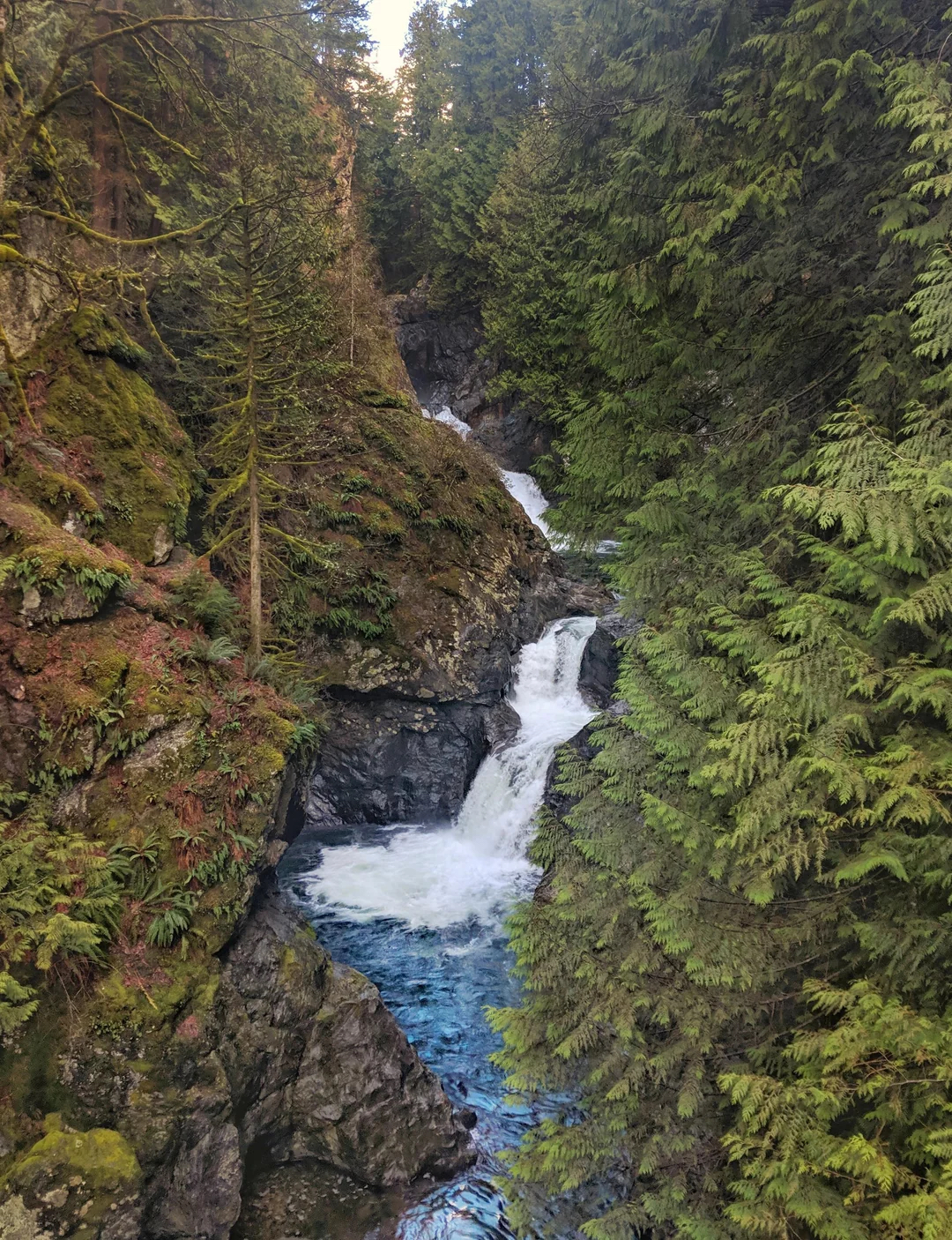
Under the forest canopy, this is a superb there-and-back hike along the Twin Falls Trail in Olallie State Park, Washington. The trail is relatively easy and short with a few very manageable uphills and downhills as the track snakes through the trees, following the river. The walk leads to the impressive spectacle of the Twin Falls and their powerful flow. This is a great family friendly option.

Already more than 200,000 users!
Uphill
202m
Highest point
291m
Downhill
202m
Lowest point
183m
Route type
There and back
Download the map on your smartphone to save battery and rest assured to always keep access to the route, even without signal.
Includes IGN France and Swisstopo.
I indicate whether dogs are allowed or prohibited on this trail
All year
0 ratings
Also enjoy:

Already more than 200,000 users!