
Grand Ballon d'Alsace
With 1,424 meters above sea level, the Grand Ballon is the highest peak in the Vosges. So high that you can see all of the Vosges, the Black Forest, the Jura, and even the Alps in good weather.
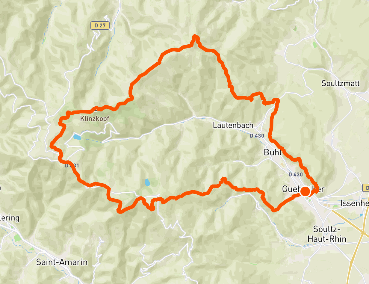
This is why we are offering you a 3-day mini-trek to discover this summit, departing from Guebwiller. The path will take you through typical Vosges spruce forests, crests or even meadows, all punctuated by inns and restaurants so that you can fully enjoy this moment in the heart of nature.
In short, here is a great hike to get away from it all for a few days.
🥾 In a nutshell
⏱ Duration: 3 days
📏 Length: 52 km
⛰ Elevation gain: 2,100 meters
💪 Difficulty: difficult
🌤 Season: preferably from May to October
🙋 Who is this trek for?
This tour of the Grand Ballon is aimed at regular hikers, who are used to walking about fifteen kilometers, with an elevation gain of around 1,000 meters.
With plenty of options for sleeping and eating, this itinerary is easily modified to suit your level.
🚆 Getting there
The starting point of this trek is located in Guebwiller, in the Haut-Rhin. Buses connect this city to Colmar and Mulhouse, which are themselves connected to many cities by train.
It is also possible to come by car, provided you find a place to park your vehicle for several days.
🛌 Sleep and eat
What greatly contributes to the charm of hiking in eastern France are the many restaurants and inns that can be found there in the heart of nature! And this mini-trek is no exception to the rule. Each step concludes with several options, which are listed in the steps below.
Bivouac is also tolerated on this route, provided you respect the usual rules: it is limited to one night in the same place, between 7 p.m. and 9 a.m., more than an hour's walk from the nearest road. Finally, fires are prohibited, and of course nothing should be left behind.
🎒 Equipment
Like any trek, this one requires a minimum of preparation. To manage it like a pro, please consult our dedicated guide: What to bring on a trek.
🥾 Day 1: from Guebwiller to the Grand Ballon
Leaving from Guebwiller, the trail quickly leaves the town to rush into the forest... and that's no joke! With more than 1,000 meters of elevation gain, this stage is the steepest of the trek.
The route goes over the Peternit pass and the rocks of Saint-Pirmin, then arrives at the Judenhut pass, which is a beautiful picnic spot due to the panorama.
Finally, the path climbs to the Grand Ballon, whose view of the plain of Alsace, the Black Forest, and sometimes beyond, rewards the efforts of the day.

🥾 Day 2: from Big Balloon to Little Balloon
If the previous stage was the one with the most elevation gain, this is the one with the most kilometres. With more than double the day before!
The path follows a line of crests making an arc between the Grand Ballon and the Petit Ballon, which makes the walk regular and pleasant, without great difference in height. In addition, the path is located above the forests, crossing flowery meadows depending on the season.
In short: a stage to be amazed.

🥾 Day 3: from Petit Ballon to Guebwiller
This last day of walking is in a way a mirror of the first. What you have climbed, you will now come back down.
Shortly after leaving the Petit Ballon, the trail leaves the open peaks and returns to the forest, joining the passes of Boenlesgrab then Bannstein.
On the last kilometres, the path overlooks Buhl and Guebwiller, crossing some vineyards established on steep slopes. And you're back to where you started!

Share your Grand Ballon experience with us on social media at @hikaguide!
Hika lists the best nature trails, on web and mobile apps!
More treks

The legendary GR20 in Corsica

Around Belle-Ile

Mercantour

In the forest of Fontainebleau

Sancy

Traverse of the Chartreuse
