Traverse of the Chartreuse
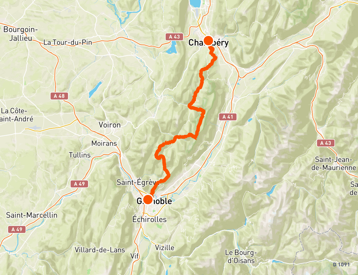
Here is a trek that stands out for its simplicity of organization. A departure from Grenoble station and an arrival at Chambéry station make it an ideal trail for hikers who prefer public transport. In addition, the four days of hiking are divided by three nights in small villages, allowing you to enjoy the local hospitality and to travel light, without a tent or sleeping bag.
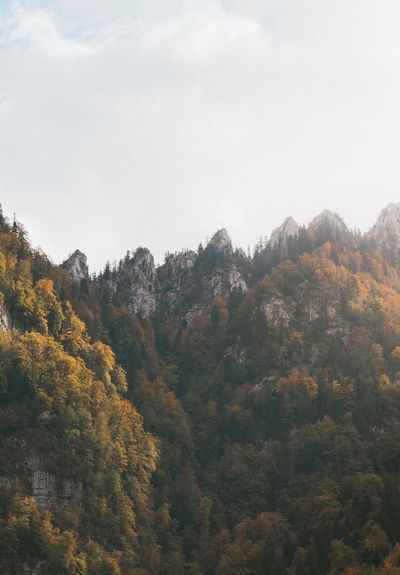
But it is not only the ease of organization that seduces us: the crossing of the Chartreuse allows you to rub shoulders with the most emblematic places of the massif such as the Chamechaude, Pinéa, Charmant Som, or the Dôme de Bellefont. An immersion in unspoiled nature where limestone cliffs are omnipresent, contrasting with the many coniferous forests. In short: a treat.
🥾 In a nutshell
⏱ Duration: 4 days
📏 Length: 86 km
⛰ Elevation gain: 5,000 meters
💪 Difficulty: difficult
🌤 Season: May to October
🙋 Who is this trek for?
This trail is for experienced hikers, who are used to hiking for about twenty kilometers with an elevation gain of more than 1,000 meters. Carrying out such a hike once is already a great performance, but here it is a matter of repeating the experience for 4 days in a row, which requires excellent physical condition.
If the stages are too ambitious, it is possible to cut the crossing of the Chartreuse into more days.
🚆 Getting there
The trail begins at Grenoble station and ends at Chambéry station. It is therefore an ideal trek if you want to get there by public transport.
🛌 Sleep and eat
This 4-day trek includes 3 nights in the following towns: Sappey-en-Chartreuse, Saint-Pierre-de-Chartreuse and Saint-Pierre-d'Entremont. Each of them includes several lodgings and restaurants, which makes it possible to do this trek with a light bag.
However, if you prefer bivouac, it is authorized in the Chartreuse Regional Natural Park, but with a few subtleties:
- Prohibition on pitching a tent in July-August in the Hauts Plateaux (sleeping under the stars is still allowed)
- Installation limited to one night in the same place
- Installation of bivouac equipment at dusk and dismantling at dawn
- No fire (but the stove is allowed)
🎒 Equipment
Like any trek, crossing the Chartreuse requires a minimum of preparation. To manage it like a pro, please consult our dedicated guide: What to bring on a trek.
🥾 Day 1: from Grenoble to Sappey-en-Chartreuse
This first stage of the crossing of the Chartreuse contains the biggest elevation gain of the four days of walking with nearly 1,500 meters.
Leaving from Grenoble station, the path crosses the Isère before climbing up to Fort de la Bastille, for a lovely view of the city. It then continues to climb below Mont Rachais, then reaches Saint-Eynard (1,379 m) and its fort, the highest point of this stage.
Finally, it will be time to take the Sentier des Crêtes to Sappey-en-Chartreuse, for a well-deserved rest.

🥾 Day 2: from Sappey-en-Chartreuse to Saint-Pierre-de-Chartreuse
From the start, the path leaves Sappey-en-Chartreuse and goes into the forest on the side of the majestic Chamechaude, with a relatively steep slope. The Col de la Porte then offers a respite, before starting a new climb leading just below the Pinéa (1,771 m) and the Charmant Som (1,867 m), all this by taking a crest line with extraordinary views.
Finally, the path descends towards Saint-Pierre-en-Chartreuse to complete the stage.

🥾 Day 3: from Saint-Pierre-de-Chartreuse to Saint-Pierre-d'Entremont
This third day of the crossing of the Chartreuse begins without detours: you will go from 880 meters of altitude to almost 1,900 meters, in a little less than 9 kilometers of walking. You will then arrive at the Bellefont pass, the highest point of the stay.
The trail then crosses the Hauts de Chartreuse national nature reserve, a vast rocky plateau bordered by cliffs. The views are once again exceptional.
Finally, the path descends towards Saint-Pierre-d'Entremont passing near the circus of Saint-Même.

🥾 Day 4: from Saint-Pierre-d'Entremont to Chambéry
This fourth and last day of the crossing of the Chartreuse offers a gradual return to civilization. The path follows valleys, and thus crosses several hamlets and villages.
It also allows you to gain height one last time, at the Pointe de la Gorgeat (1,486 m).
Finally, the route crosses the center of Chambéry and ends at the railway station.

Share your experience of crossing the Chartreuse on social networks at @hikaguide!
Hika lists the best nature trails, on web and mobile apps!
More treks

The legendary GR20 in Corsica

Around Belle-Ile

Mercantour

In the forest of Fontainebleau

Grand Ballon d'Alsace

Sancy
