Uphill
1492m
France > Auvergne-Rhône-Alpes > Isère
Length
17km
Duration
8h30min
Elev gain
1492m
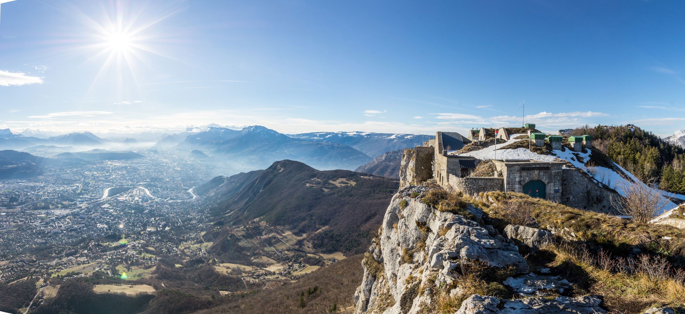
This first stage of the crossing of the Chartreuse contains the biggest elevation gain of the four days of walking with close to 1,500 metres.
Leaving from Grenoble station, the path crosses the Isère before climbing up to Fort de la Bastille, for a lovely view of the city. It then continues to climb below Mont Rachais, then reaches Saint-Eynard (1,379 m) and its fort, the highest point of this leg.
Finally, it will be time to take the Sentier des Crêtes to Sappey-en-Chartreuse, for a well-deserved rest.

Already more than 200,000 users!
Uphill
1492m
Highest point
1348m
Downhill
703m
Lowest point
210m
Route type
One way
Download the map on your smartphone to save battery and rest assured to always keep access to the route, even without signal.
Includes IGN France and Swisstopo.
Le Sappey-en-Chartreuse has several gîtes and restaurants for the evening.
I indicate whether dogs are allowed or prohibited on this trail
Can be difficult in Winter
3 ratings
Also enjoy:

Already more than 200,000 users!


