Uphill
580m
Length
12km
Duration
4h30min
Elev gain
580m
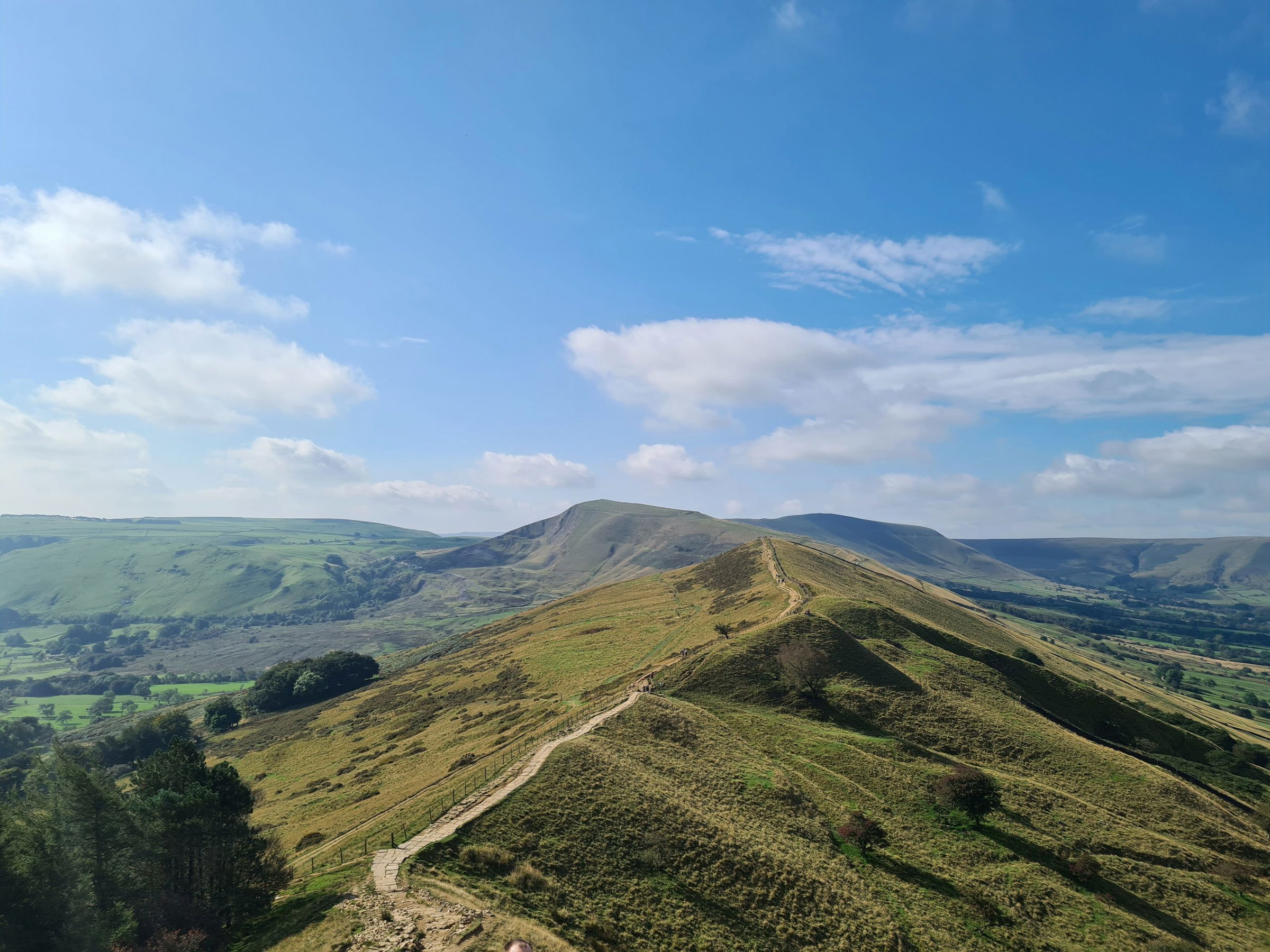
Discover this great loop to Mam Tor and Lose Hill starting from Castleton in the Peak District National Park, only 45 minutes away from Sheffield and a bit over an hour from Manchester. The trail is moderate albeit a bit long and begins uphill passing by the 11th century ruin of the Peveril Castle and carrying on uphill all the way to Mam Tor, the Shivering Mountain, with a stair section towards the top. There, the views are fantastic opening on the surrounding peaks and valleys. The route carries on to a cairn at the top of Lose Hill, with a few other landmarks on the way before coming back down to Castleton. The terrain varies between rocky trails (which can get muddy) and stony paved paths, and is overall very manageable. This is a popular route and can get quite busy on weekends or when the weather is lovely.

Already more than 200,000 users!
Uphill
580m
Highest point
512m
Downhill
580m
Lowest point
163m
Route type
Loop
Download the map on your smartphone to save battery and rest assured to always keep access to the route, even without signal.
Includes IGN France and Swisstopo.
Castleton Car Park - HPBC at the beginning of the trail.
Hope and Edale stations nearby.
I indicate whether dogs are allowed or prohibited on this trail
All year
0 ratings
Also enjoy:

Already more than 200,000 users!


