Uphill
355m
France > Auvergne-Rhône-Alpes > Cantal > Volcans d'Auvergne Regional Natural Park
Length
8km
Duration
3h
Elev gain
355m
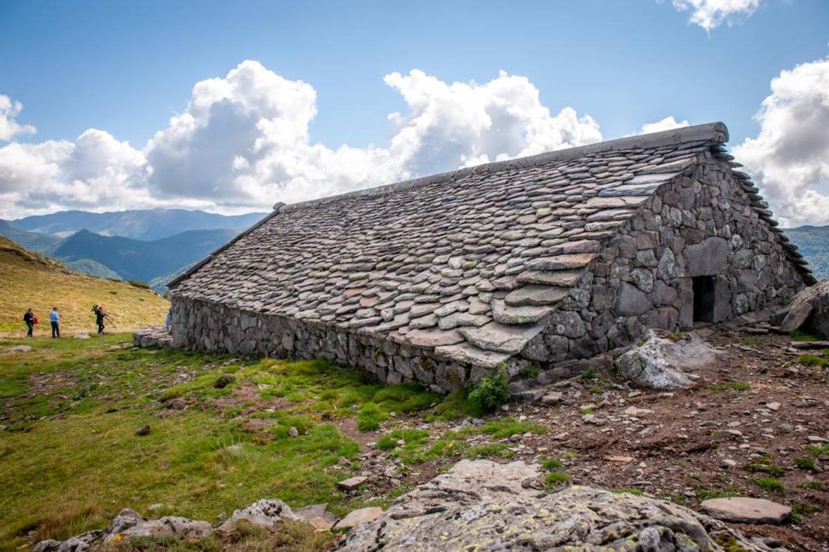
Pretty hike starting from the Col de Légal. The route passes through the buron de Légal then very close to the Puy de Bassierou, before arriving at the bédélat du Cassaïre. An integral part of Cantal's heritage, this small stone building was renovated in 2021.

Already more than 200,000 users!
Uphill
355m
Highest point
1513m
Downhill
355m
Lowest point
1226m
Route type
There and back
Download the map on your smartphone to save battery and rest assured to always keep access to the route, even without signal.
Includes IGN France and Swisstopo.
I indicate whether dogs are allowed or prohibited on this trail
Can be difficult in Winter
0 ratings
Also enjoy:

Already more than 200,000 users!


