Uphill
271m
Length
5km
Duration
2h
Elev gain
271m
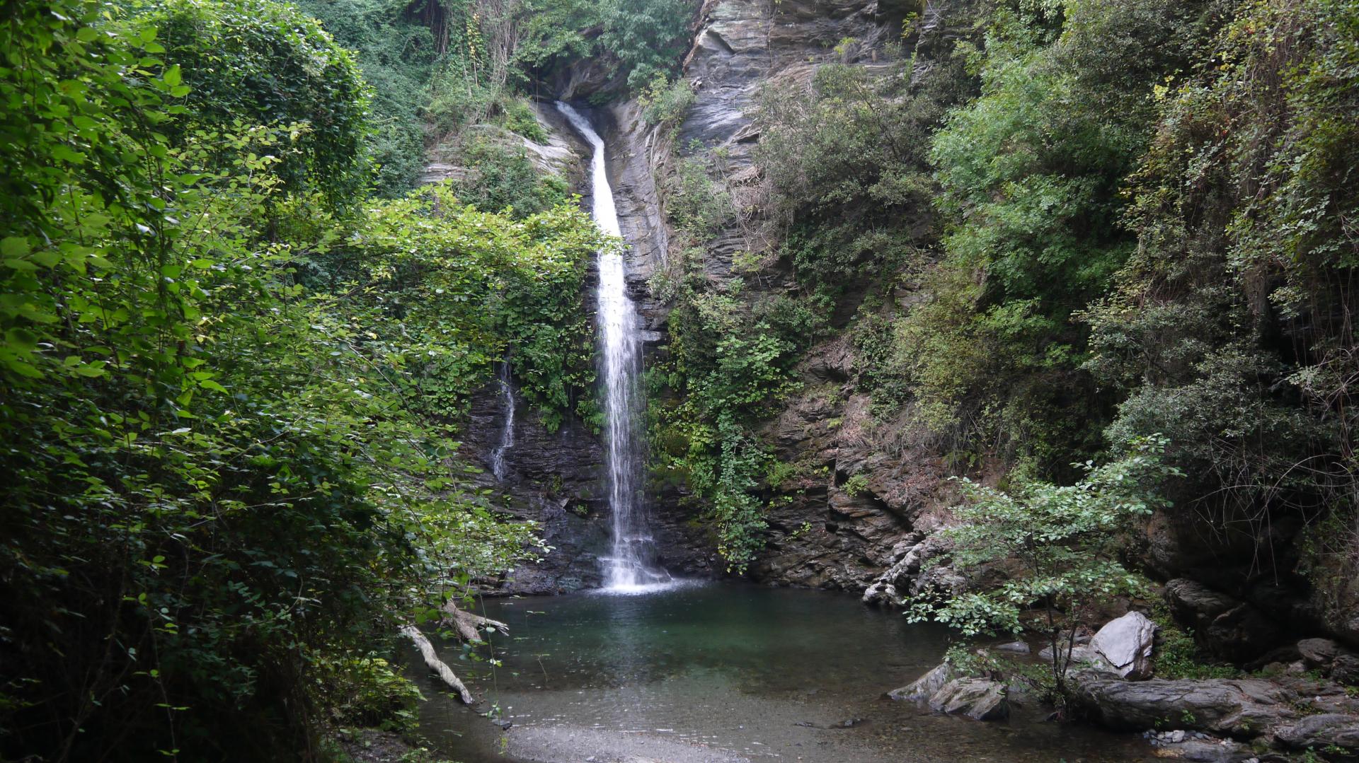
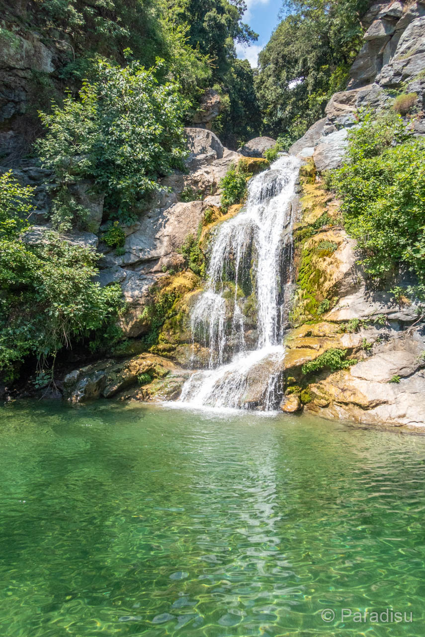
After a stroll on small roads, this circuit takes a shaded path to the pretty Bucatoggio waterfall. Large basins formed in the river invite you for a swim.

Already more than 200,000 users!
Uphill
271m
Highest point
300m
Downhill
271m
Lowest point
44m
Route type
Loop
Download the map on your smartphone to save battery and rest assured to always keep access to the route, even without signal.
Includes IGN France and Swisstopo.
I indicate whether dogs are allowed or prohibited on this trail
All year
12 ratings
Très bonne randonnée nous l avons fait avec un enfant de 8ans et de 4ans un peu dur faut porter un peu mais la cascade est vraiment belle je recommande de partir par la route environ 1km et ensuite dans les sentiers ombragé c est parfait pour une arrivée à la cascade on peut se baigner et le parking sera a 800m
La cascade et le pont génois valent le détour. Nous vous conseillons de commencer par la fin qui vaudrait un très bien, soit jusqu’à la cascade mais la suite de la « marche » est sans réel point d’intérêt à notre goût. Attention parking payant de mai à octobre, prévoir 5e.
Très bien, sentier puis chemin dans la forêt, bonnes chaussures conseillées car caillouteux. Cascade rafraîchissante.
Also enjoy:

Already more than 200,000 users!