Uphill
53m
Length
2km
Duration
30min
Elev gain
53m
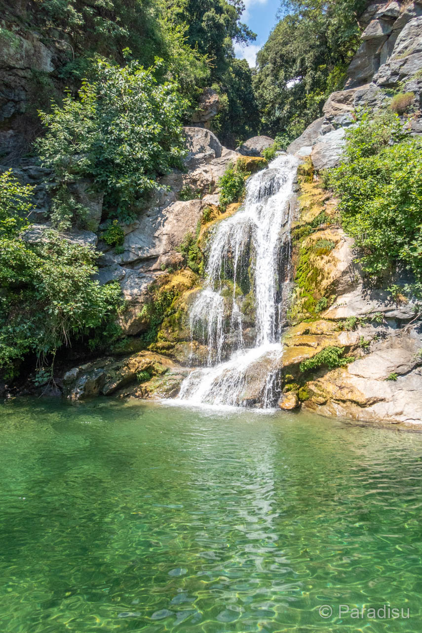
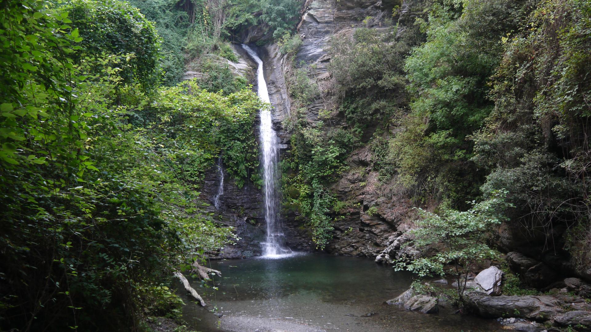
Walk to a pretty waterfall about ten meters high, which flows into a natural swimming pool. All this, in a very pleasant forest setting.

Already more than 200,000 users!
Uphill
53m
Highest point
631m
Downhill
53m
Lowest point
597m
Route type
There and back
Download the map on your smartphone to save battery and rest assured to always keep access to the route, even without signal.
Includes IGN France and Swisstopo.
I indicate whether dogs are allowed or prohibited on this trail
All year
1 rating
Jolie cascade, eau fraîche, adaptée aux enfants tant dans l’accès que pour jouer/baignade. Aire de picnic en hauteur très appréciable, ombragé.
Also enjoy:

Already more than 200,000 users!