Uphill
170m
Length
5km
Duration
1h30min
Elev gain
170m
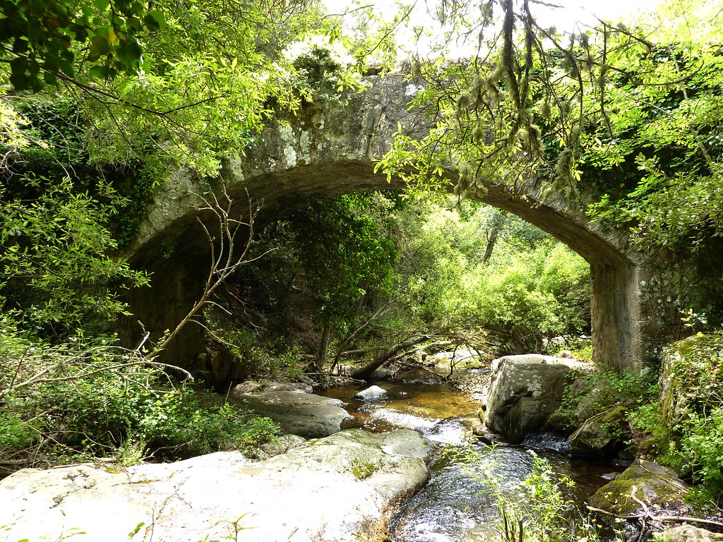
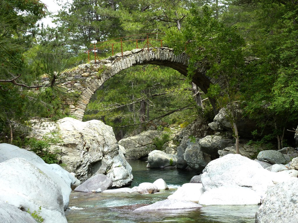
Shaded round-trip walk to a pretty Genoese bridge located on the Tartagine river.

Already more than 200,000 users!
Uphill
170m
Highest point
721m
Downhill
170m
Lowest point
563m
Route type
There and back
Download the map on your smartphone to save battery and rest assured to always keep access to the route, even without signal.
Includes IGN France and Swisstopo.
I indicate whether dogs are allowed or prohibited on this trail
All year
0 ratings
Also enjoy:

Already more than 200,000 users!