Uphill
453m
France > Grand Est > Haut-Rhin > Ballons des Vosges Regional Natural Park
Length
7km
Duration
3h30min
Elev gain
453m
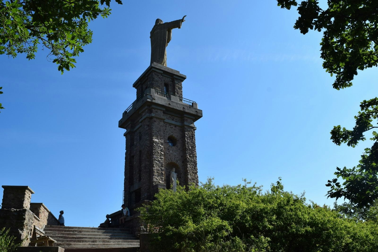
Starting from the village of Katzenthal, this hike makes a loop to Galtz, at an altitude of 732 metres. This summit is overlooked by a statue of Christ 23 meters high, dedicated to the memory of the victims of the Great War.
The path also passes near Wineck Castle and the Felix Spitz stele.

Already more than 200,000 users!
Uphill
453m
Highest point
720m
Downhill
453m
Lowest point
288m
Route type
Loop
Download the map on your smartphone to save battery and rest assured to always keep access to the route, even without signal.
Includes IGN France and Swisstopo.
I indicate whether dogs are allowed or prohibited on this trail
All year
1 rating
Also enjoy:

Already more than 200,000 users!


