Uphill
559m
France > Grand Est > Haut-Rhin > Ballons des Vosges Regional Natural Park
Length
11km
Duration
4h30min
Elev gain
559m
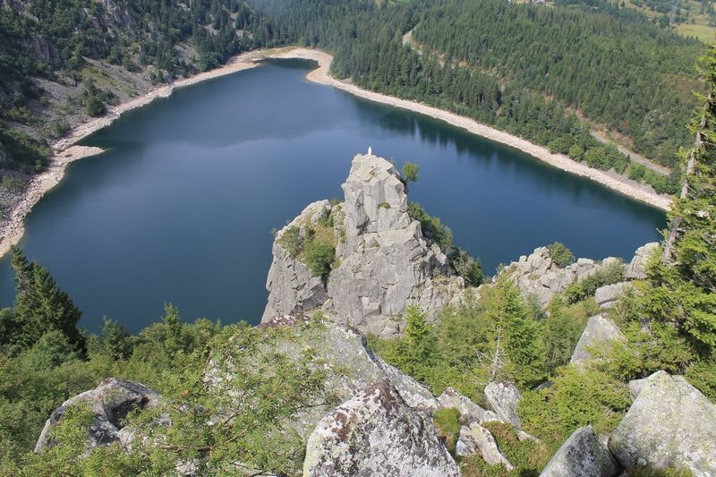
Departing from the Lac Blanc car park, this trail begins by climbing to offer a beautiful panorama of the lake, before descending to the level of Lac Noir. Finally, it goes up one last time to cross the lawn of Faing.

Already more than 200,000 users!
Uphill
559m
Highest point
1309m
Downhill
559m
Lowest point
959m
Route type
Loop
Download the map on your smartphone to save battery and rest assured to always keep access to the route, even without signal.
Includes IGN France and Swisstopo.
I indicate whether dogs are allowed or prohibited on this trail
Can be difficult in Winter
8 ratings
Pour le coup, je confirme qu'en hiver c'est plus difficile. Aucun problème avec la neige. Par contre avec le verglas...
C'est uniquement pour les plus courageux je dirais :) Sinon top !
Magnifique.
Also enjoy:

Already more than 200,000 users!


