Uphill
526m
Length
11km
Duration
4h
Elev gain
526m
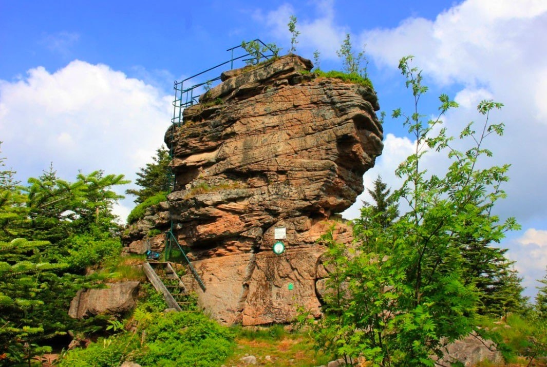
Pretty hike climbing the head of Raves, 874 meters above sea level. The route makes a loop in the forest, which is ideal in hot weather, and is full of surprises: viewpoints, preserved flora, and vestiges of the First World War.

Already more than 200,000 users!
Uphill
526m
Highest point
881m
Downhill
526m
Lowest point
534m
Route type
Loop
Download the map on your smartphone to save battery and rest assured to always keep access to the route, even without signal.
Includes IGN France and Swisstopo.
I indicate whether dogs are allowed or prohibited on this trail
All year
0 ratings
Also enjoy:

Already more than 200,000 users!


