Uphill
87m
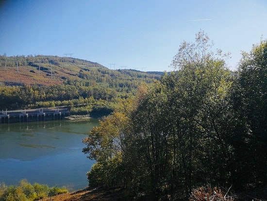
France > Grand Est > Ardennes > Ardennes Regional Natural Park
Length
9km
Duration
2h30min
Elev gain
87m
Located south of Revin, this walk makes a nice loop between Whitaker Basin and Faux Creek. A beautiful route along the water in perspective!

Already more than 200,000 users!
Uphill
87m
Highest point
226m
Downhill
87m
Lowest point
168m
Route type
Loop
Download the map on your smartphone to save battery and rest assured to always keep access to the route, even without signal.
Includes IGN France and Swisstopo.
I indicate whether dogs are allowed or prohibited on this trail
All year
0 ratings
Also enjoy:

Already more than 200,000 users!


