Uphill
1723m

Length
19km
Duration
11h30min
Elev gain
1723m
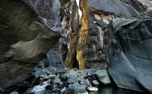
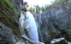
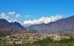
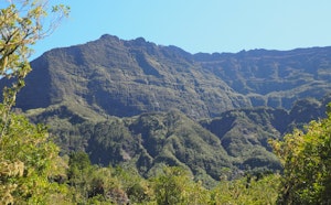
This waterfall is certainly one of the most spectacular on the island, the Galets river giving the impression of disappearing into an endless precipice. Along the way, discover the Taïbit pass and the village of Marla, and viewpoints on the Cirque de Mafate.

Already more than 200,000 users!
Uphill
1723m
Highest point
2094m
Downhill
1723m
Lowest point
1229m
Route type
There and back
Download the map on your smartphone to save battery and rest assured to always keep access to the route, even without signal.
Includes IGN France and Swisstopo.
Limited parking at the start of the hike, along the road or at the Bras Rouge bivouac.
Authorised
Difficult after heavy rains
0 ratings
Also enjoy:

Already more than 200,000 users!