Uphill
651m

Length
7km
Duration
4h30min
Elev gain
651m
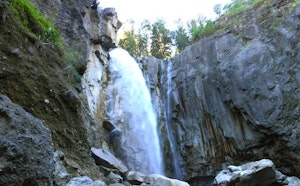
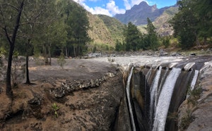
Departing from Cilaos, this route follows the Chapelle canyon on the Bras Rouge river, a magnificent site made up of volcanic rocks. A waterfall and a pool are also present, where it is possible to swim.

Already more than 200,000 users!
Uphill
651m
Highest point
1119m
Downhill
651m
Lowest point
785m
Route type
There and back
Download the map on your smartphone to save battery and rest assured to always keep access to the route, even without signal.
Includes IGN France and Swisstopo.
I indicate whether dogs are allowed or prohibited on this trail
Difficult after heavy rains
2 ratings
Also enjoy:

Already more than 200,000 users!