Uphill
142m
Length
12km
Duration
3h30min
Elev gain
142m
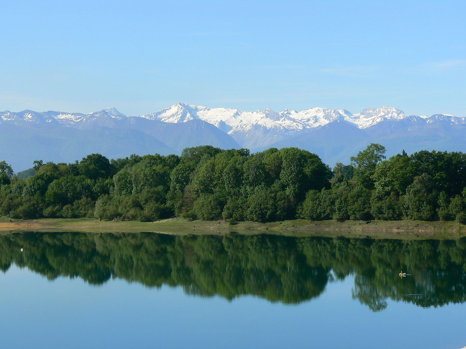
Family-friendly hike around Lake Gabas. The wildlife is beautiful and the trail is accessible to all. But it is the majestic Pyrenees, in the distance, that capture all our attention.

Already more than 200,000 users!
Uphill
142m
Highest point
381m
Downhill
142m
Lowest point
339m
Route type
Loop
Download the map on your smartphone to save battery and rest assured to always keep access to the route, even without signal.
Includes IGN France and Swisstopo.
I indicate whether dogs are allowed or prohibited on this trail
All year
0 ratings
Also enjoy:

Already more than 200,000 users!