Uphill
264m
France > Occitanie > Hautes-Pyrénées > Pyrénées National Park
Length
7km
Duration
2h30min
Elev gain
264m
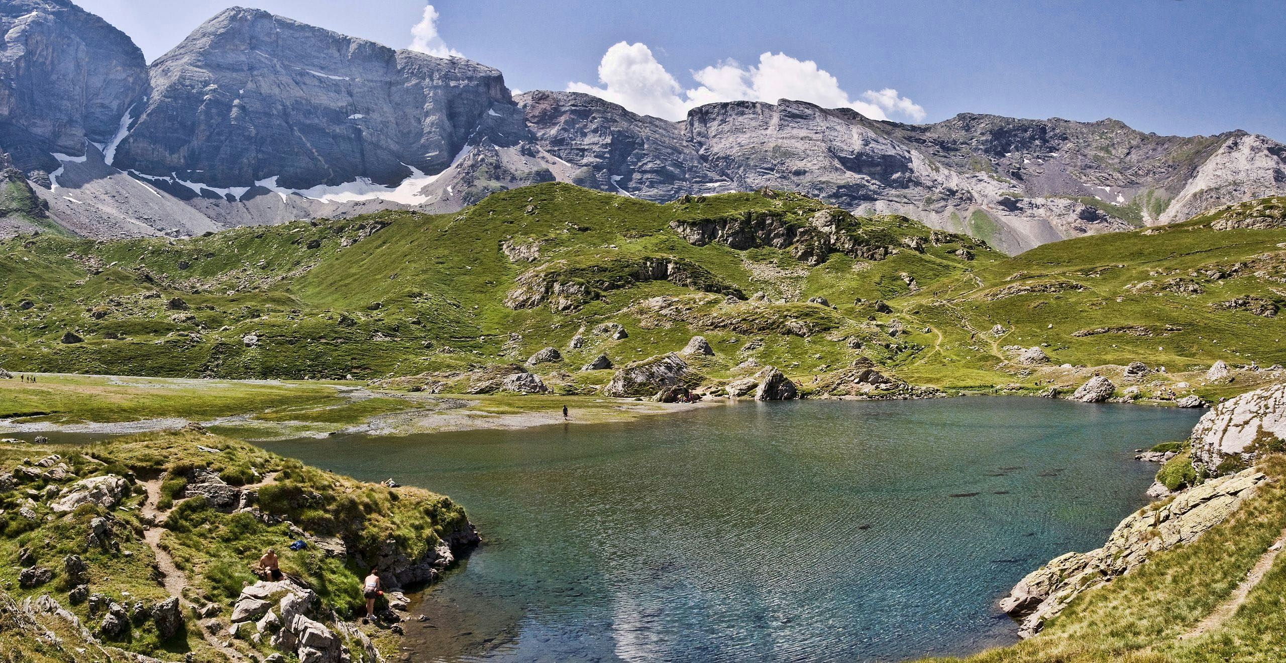
Of the three cirques in the Pyrenees National Park, that of Troumouse is the largest. But its immense size is not its only quality: it is also incredibly wild, as if far from civilization. And its walls, marking the border with Spain, are simply grandiose.
Note that many lakes are an ideal setting for a picnic.
In short, a must see in the region.

Already more than 200,000 users!
Uphill
264m
Highest point
2139m
Downhill
264m
Lowest point
2052m
Route type
Loop
Download the map on your smartphone to save battery and rest assured to always keep access to the route, even without signal.
Includes IGN France and Swisstopo.
In summer: park at Parking du Maillet, then take a shuttle (€7) to the start of the hike. Or walk, which adds about half an hour in each way.
Otherwise: limited parking at the start of the hike.
3 ratings
Voilà un cirque majestueux ! Il forme un très grand arc de cercle, bien plus vaste que Gavarnie. Et surtout la balade se situe sur un plateau, ce qui donne la vague impression d’être coupé du monde en contrebas. Un paradis naturel.
Also enjoy:

Already more than 200,000 users!


