Uphill
289m
Length
3km
Duration
2h
Elev gain
289m
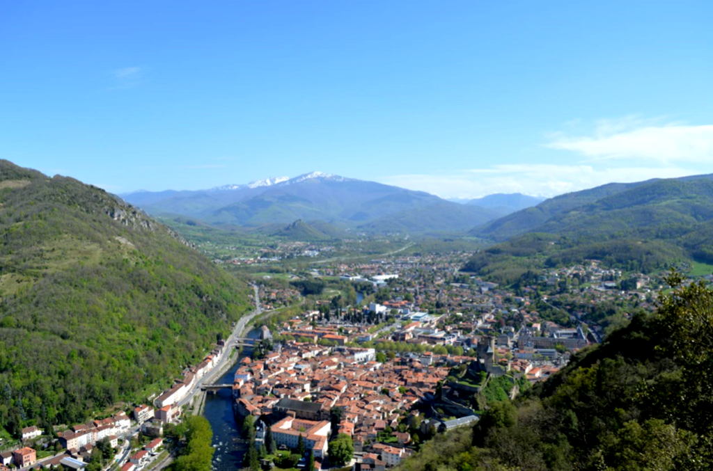
Departing from Foix, this short walk to Saint-Sauveur offers a bird's eye view of the castle and the old town.

Already more than 200,000 users!
Uphill
289m
Highest point
686m
Downhill
289m
Lowest point
390m
Route type
There and back
Download the map on your smartphone to save battery and rest assured to always keep access to the route, even without signal.
Includes IGN France and Swisstopo.
I indicate whether dogs are allowed or prohibited on this trail
All year
1 rating
Balade très sympa,
Lever la tête dans la montée afin de ne pas rater la bifurcation qui part en épingle sur la gauche et arrive tout droit à la croix. Après la croix, il est possible de continuer quelques dizaines de mètres pour arriver jusqu’à un plateau. Très belle vue, grande étendue beaucoup plus agréable pour picknick ou sieste.
Also enjoy:

Already more than 200,000 users!