Uphill
630m

Length
8km
Duration
4h30min
Elev gain
630m
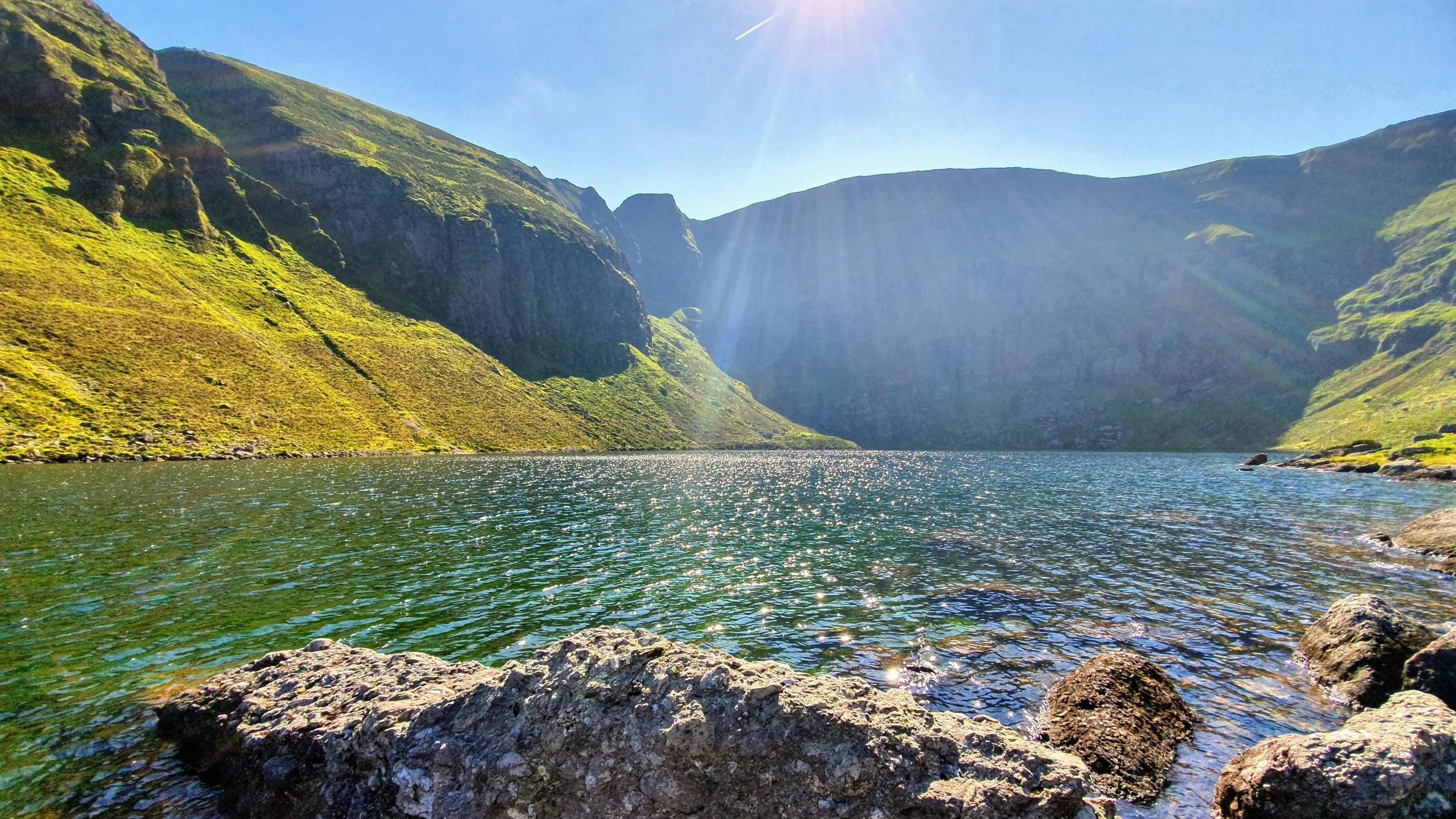
This is a challenging and beautiful loop following the Coumshingaun Lough Walk and stopping by Kilclooney Peak before coming back down in County Waterford. The trail begins on a slow incline for just a kilometre and then becomes very steep, the way down similarly follows a steep incline. There are quite a few rocky patches and hikers will have to scramble a bit. It’s best to attempt the route only if there is good visibility. The views throughout are fantastic, particularly at the top with Coumshingaun Lough below and the far reaching plains in the distance.

Already more than 200,000 users!
Uphill
630m
Highest point
776m
Downhill
630m
Lowest point
157m
Route type
Loop
Download the map on your smartphone to save battery and rest assured to always keep access to the route, even without signal.
Includes IGN France and Swisstopo.
I indicate whether dogs are allowed or prohibited on this trail
All year
1 rating
Also enjoy:

Already more than 200,000 users!