Uphill
735m

Length
13km
Duration
5h30min
Elev gain
735m
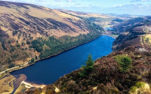
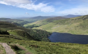
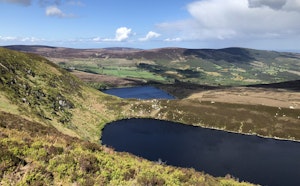
This is a great albeit challenging there-and-back hike to the top of Lugnquilla at 925 metres in the Wicklow Mountains National Park. After two kilometres, the route begins to steeply go uphill following rocky trails to the summit, At the top signalled by a cairn, hikers will emerge on a plateau and enjoy fantastic views of the surrounding mounts and the vast plains.

Already more than 200,000 users!
Uphill
735m
Highest point
930m
Downhill
735m
Lowest point
189m
Route type
There and back
Download the map on your smartphone to save battery and rest assured to always keep access to the route, even without signal.
Includes IGN France and Swisstopo.
I indicate whether dogs are allowed or prohibited on this trail
All year
0 ratings
Also enjoy:

Already more than 200,000 users!