Uphill
68m
Length
13km
Duration
5h30min
Elev gain
68m
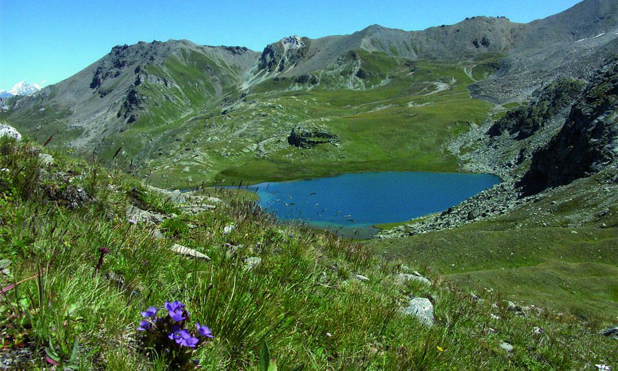
This fifth and final stage leaves the Becs de Bosson hut and descends into the Vallon de Réchy, which is as wild as it is magnificent. The path continues at the foot of Mont Noble, in the heart of the alpine pastures, then in the forest to Nax.
Located on a rocky promontory, the village of Nax offers a pretty panorama of the Rhône valley. It is possible to take a bus there to reach Sion station.

Already more than 200,000 users!
Uphill
68m
Highest point
2982m
Downhill
1773m
Lowest point
1262m
Route type
One way
Download the map on your smartphone to save battery and rest assured to always keep access to the route, even without signal.
Includes IGN France and Swisstopo.
I indicate whether dogs are allowed or prohibited on this trail
From June to September
0 ratings
Also enjoy:

Already more than 200,000 users!


