
Crests and valleys of the Jura
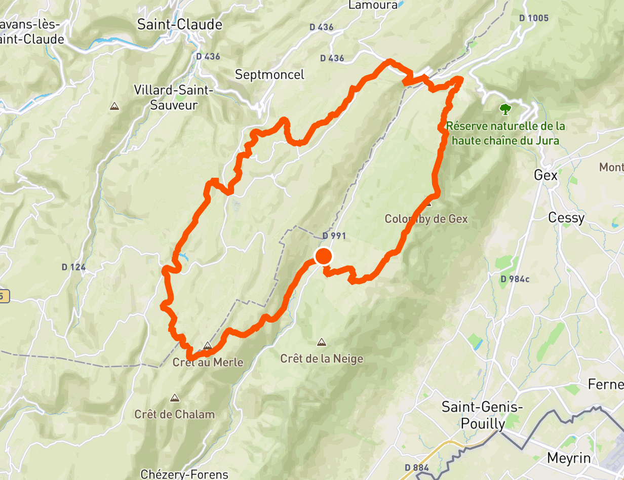
Departing from Lélex, this trail begins by taking the ridges of the high Jura range, thus offering a magnificent panorama of Lake Geneva and the Alps. The route then crosses the Valserine valley and then crosses the typical valleys of the Jura, covered with undergrowth and meadows.
Here is an itinerary offering a wide variety of landscapes in just three days, with stops in the villages of Mijoux and Moussières.
🥾 In a nutshell
⏱ Duration: 3 days
📏 Length: 53 km
⛰ Elevation gain: 2,300 meters
💪 Difficulty: difficult
🌤 Season: May to October
🙋 Who is this trek for?
This trek in the Jura massif is aimed at experienced hikers, who are used to walking about fifteen kilometers, with an elevation gain of around 700 meters.
🚆 Getting there
The starting point of this trek is located in Lélex, where a large car park allows you to leave your car near the town hall.
For those who prefer public transport, it is possible to take a train to Bellegarde station, then a coach to Lélex. The coach journey takes approximately 50 minutes.
🛌 Sleep and eat
This 3-day trek includes 2 nights in the following villages: Mijoux and Les Moussières. Each of them includes several lodgings and restaurants, which makes it possible to do this trek with a light bag. Our recommendations are indicated within each step.
However, if you prefer a tent, it is possible to bivouac near Mijoux and Les Moussières, subject to agreement with the landowners. On the other hand, it is forbidden to bivouac within the Haute Chaîne du Jura nature reserve, which is crossed during the first stage.
🎒 Equipment
Like any trek, this one requires a minimum of preparation. To manage it like a pro, please consult our dedicated guide: What to bring on a trek.
🥾 Day 1: panoramas on the crests
Leaving from Lélex, this first day of walking begins with a steep ascent in the undergrowth. The first three kilometers thus make it possible to take more than 500 meters of elevation gain, in order to leave the forest and reach a line of crests.
The path then passes through Colomby de Gex (1,689 m), the highest point of the stage. The panorama opens onto Geneva, Lake Geneva and the Alps.
You then have to go down almost everything that has been climbed! The path goes through the Col de la Faucille then joins Mijoux to end this stage.

🥾 Day 2: valleys and forests
This second day contrasts sharply with the first, which was marked by elevation, ridges and open panoramas. Indeed, this new stage crosses mid-mountain landscapes, alternating between undergrowth, meadows, fields, and farms, all without steep slopes.
The route takes small roads several times before reaching the village of Moussières.

🥾 Day 3: the Borne au Lion
This last stage continues in line with the previous one, with landscapes of meadows and undergrowth typical of the Jura. The path runs along the small lake of L'Embouteilleux, then joins the famous Borne au Lion. Installed in 1613, it marked the border between the kingdom of France and Franche-Comté, which then depended on... Spain! It was also a center of resistance during the Second World War.
After admiring the view of the ridges traveled during the first day of the trek, you can continue walking on tracks, paths and small roads, in order to descend into the forest towards Lélex, and thus end this adventure.

Share your experience of this trek with us on social networks at @hikaguide!
Hika lists the best nature trails, on web and mobile apps!
More treks

The legendary GR20 in Corsica

Around Belle-Ile

Mercantour

In the forest of Fontainebleau

Grand Ballon d'Alsace

Sancy

Traverse of the Chartreuse
