Uphill
315m
Length
4km
Duration
2h
Elev gain
315m
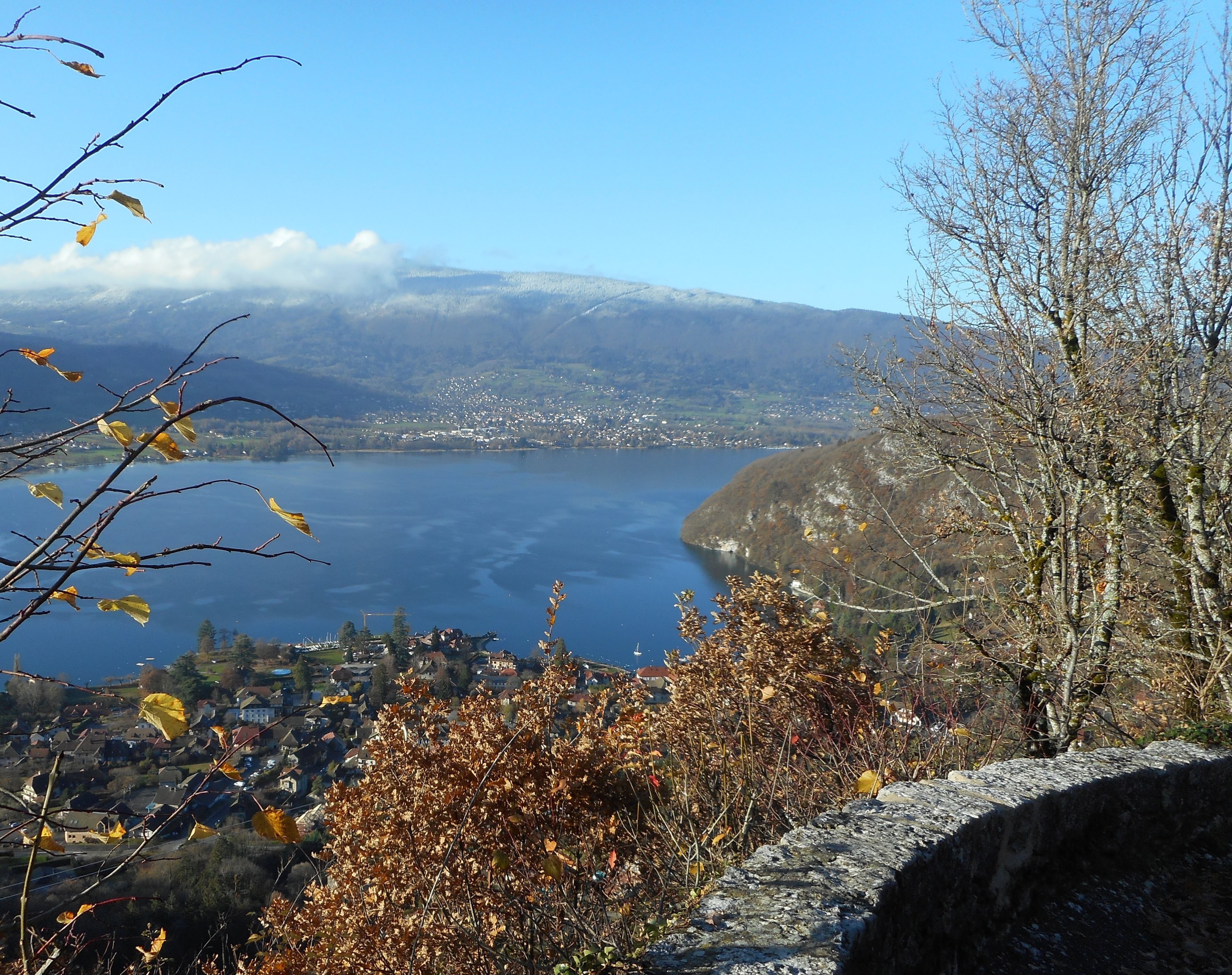
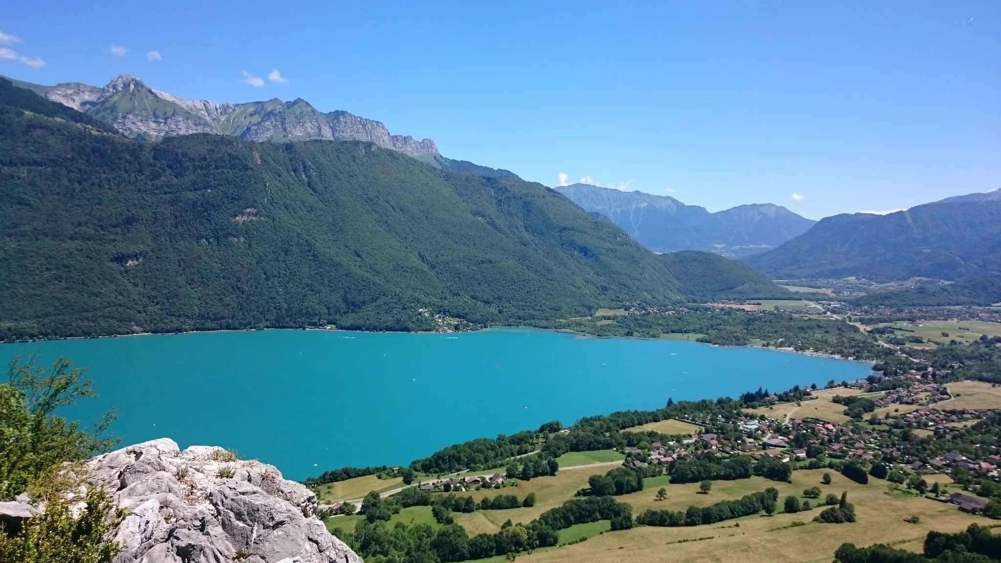
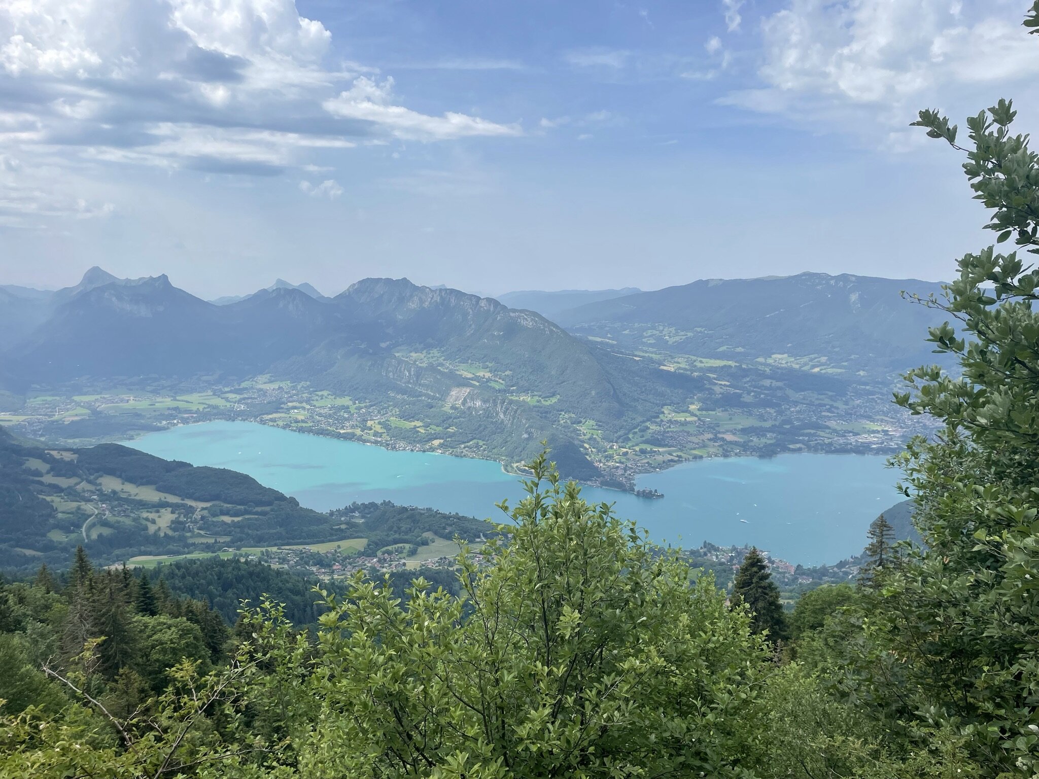
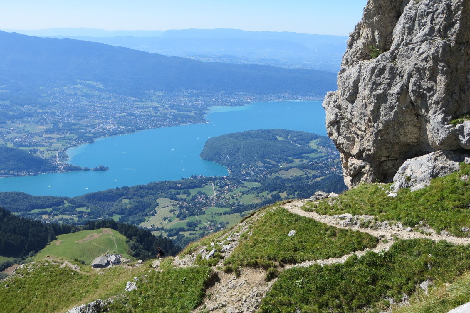
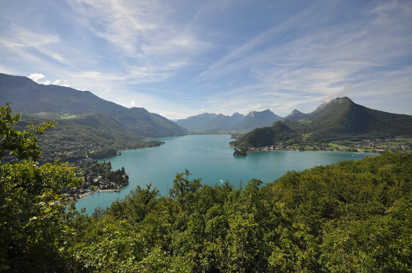
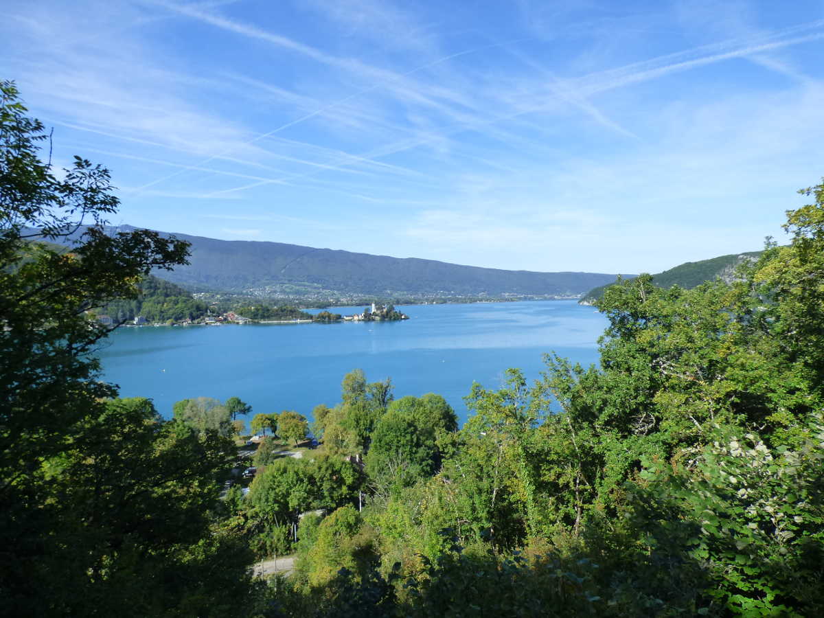
Rather steep trail to discover varied landscapes, between undergrowth, meadow, and a waterfall. Lovely views over Lake Annecy and La Tournette.

Already more than 200,000 users!
Uphill
315m
Highest point
766m
Downhill
315m
Lowest point
465m
Route type
Loop
Download the map on your smartphone to save battery and rest assured to always keep access to the route, even without signal.
Includes IGN France and Swisstopo.
I indicate whether dogs are allowed or prohibited on this trail
All year
7 ratings
Grimpe fort mais très sympa, plus de monde à la cascade prenant le parking à côté sinon personne sur le sentier !
Also enjoy:

Already more than 200,000 users!