Uphill
414m

France > La Réunion > La Réunion National Park
Length
7km
Duration
3h
Elev gain
414m
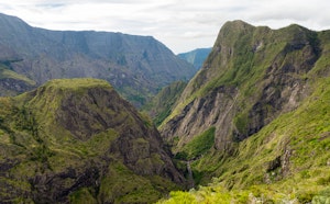
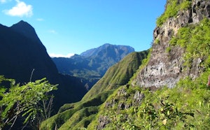
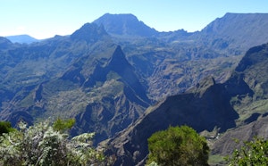
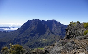
Superb hike in the Piton des Neiges massif, along the Orangers ridge. The course makes a loop and offers pretty views of the surroundings, especially the famous Pic du Maïdo.

Already more than 200,000 users!
Uphill
414m
Highest point
2359m
Downhill
414m
Lowest point
2132m
Route type
Loop
Download the map on your smartphone to save battery and rest assured to always keep access to the route, even without signal.
Includes IGN France and Swisstopo.
Authorised
Difficult after heavy rains
10 ratings
Rando très sympa
Des passages assez compliqués pour des familles
Incroyable cette vue. Peut être l’une des plus belle de la réunion.
De nombreux sentiers sont possibles. Terrain « lunaire » agréable pour faire de la randonnée.
Also enjoy:

Already more than 200,000 users!