Uphill
592m

Length
12km
Duration
4h30min
Elev gain
592m
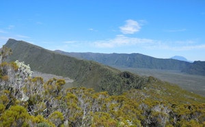
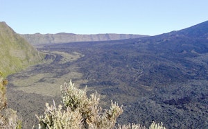
Among the most active volcanoes on the planet, Piton de la Fournaise is often simply called "the volcano" on the island. Its ascent takes place in a lunar setting, for a total change of scenery.

Already more than 200,000 users!
Uphill
592m
Highest point
2468m
Downhill
592m
Lowest point
2204m
Route type
There and back
Download the map on your smartphone to save battery and rest assured to always keep access to the route, even without signal.
Includes IGN France and Swisstopo.
Authorised
All year except during volcanic eruptions 🌋
8 ratings
Super rando mais plus compliqué que le niveau moyen annoncé
Also enjoy:

Already more than 200,000 users!