Uphill
6m
Length
5km
Duration
1h
Elev gain
6m
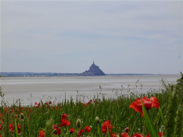
Nice walk that goes around the tip of Saint-Léonard. The route runs along the coast and ends at the Saint-Léonard les Vains belvedere, offering a breathtaking view of Mont-Saint-Michel. Splendid!

Already more than 200,000 users!
Uphill
6m
Highest point
23m
Downhill
6m
Lowest point
7m
Route type
Loop
Download the map on your smartphone to save battery and rest assured to always keep access to the route, even without signal.
Includes IGN France and Swisstopo.
I indicate whether dogs are allowed or prohibited on this trail
All year
1 rating
Also enjoy:

Already more than 200,000 users!


