Uphill
13m
Length
9km
Duration
2h
Elev gain
13m
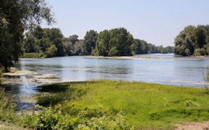
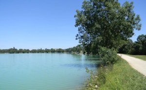
Here is a nice walk along the water near Moissac. The path runs along the Tarn throughout the first part of the route before returning towards the starting point along the side channel of the Garonne, on the Chemin de la Pointe.

Already more than 200,000 users!
Uphill
13m
Highest point
78m
Downhill
13m
Lowest point
59m
Route type
There and back
Download the map on your smartphone to save battery and rest assured to always keep access to the route, even without signal.
Includes IGN France and Swisstopo.
I indicate whether dogs are allowed or prohibited on this trail
All year
0 ratings
Also enjoy:

Already more than 200,000 users!