Uphill
623m
Length
9km
Duration
4h30min
Elev gain
623m
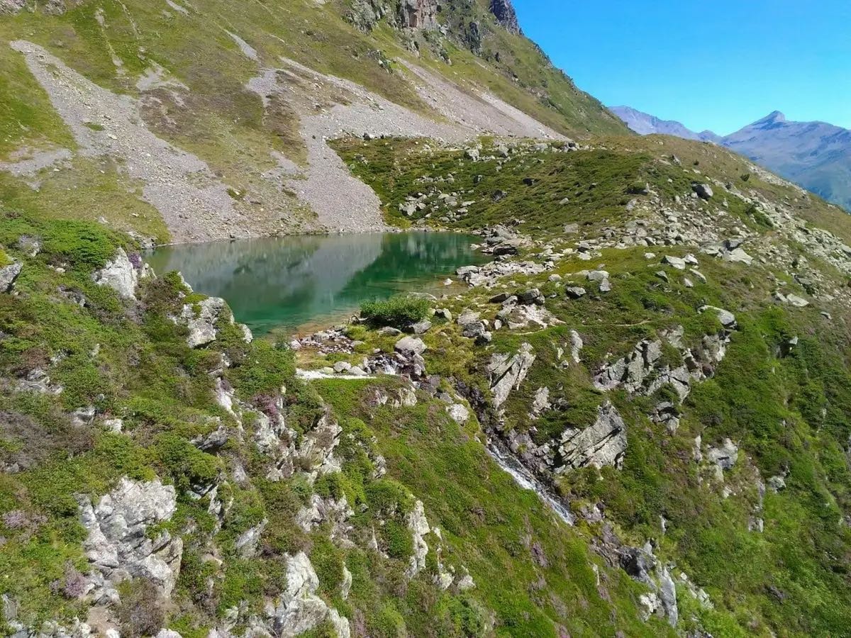
Round-trip hike to a pretty high-altitude lake, perched on its granite balcony. The climb is steep but the landscapes are up to the effort.

Already more than 200,000 users!
Uphill
623m
Highest point
2019m
Downhill
623m
Lowest point
1432m
Route type
There and back
Download the map on your smartphone to save battery and rest assured to always keep access to the route, even without signal.
Includes IGN France and Swisstopo.
I indicate whether dogs are allowed or prohibited on this trail
From May to September
0 ratings
Also enjoy:

Already more than 200,000 users!


