Uphill
900m
France > Occitanie > Pyrénées-Orientales > Catalan Pyrenees Regional Natural Park
Length
15km
Duration
6h30min
Elev gain
900m
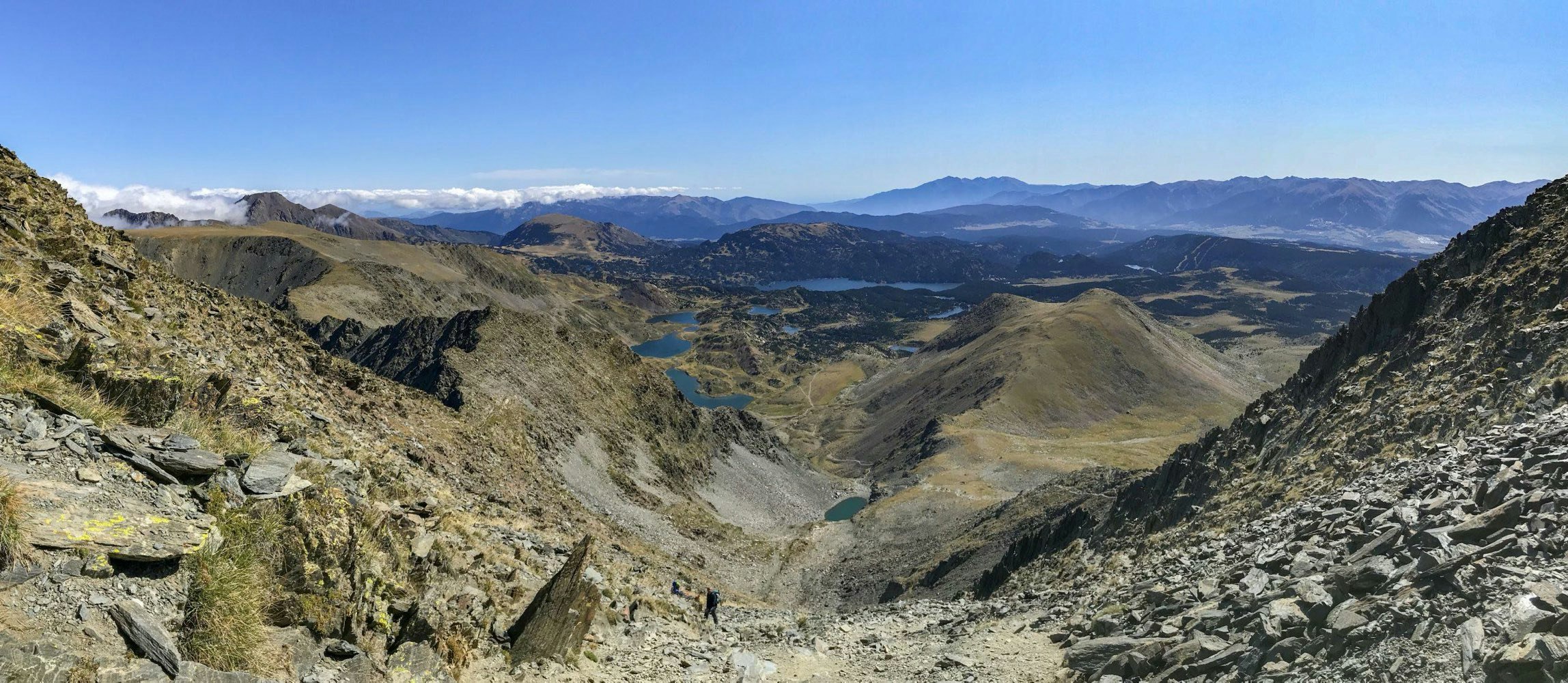
Difficult ascent to the highest point of the Pyrénées Orientales, passing through numerous high-altitude lakes. The trail is rocky, steep, and requires the use of hands on the last kilometers.
Very nice panorama on arrival.

Already more than 200,000 users!
Uphill
900m
Highest point
2895m
Downhill
900m
Lowest point
2000m
Route type
There and back
Download the map on your smartphone to save battery and rest assured to always keep access to the route, even without signal.
Includes IGN France and Swisstopo.
Several car parks at the Lac des Bouillouses dam.
However, in summer it may be necessary to park lower and take a shuttle.
Authorised on a leash
From June to September
5 ratings
Excellente rando ! On a pu se garer au barrage mais apparemment ce n’est pas possible en toutes saisons - à vérifier à l’avance.
Franchement à l’approche du sommet c’est presque de l’escalade, il faut s’aider des mains et c’est assez vertigineux. Mais la vue en vaut la chandelle. Si ça vous paraît trop ambitieux, le départ de la rando mérite aussi le détour, autour des lacs du Carlit.
Also enjoy:

Already more than 200,000 users!


