Uphill
356m
Length
8km
Duration
3h
Elev gain
356m
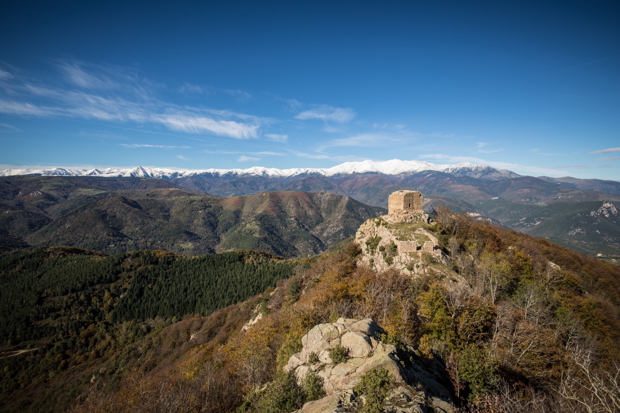
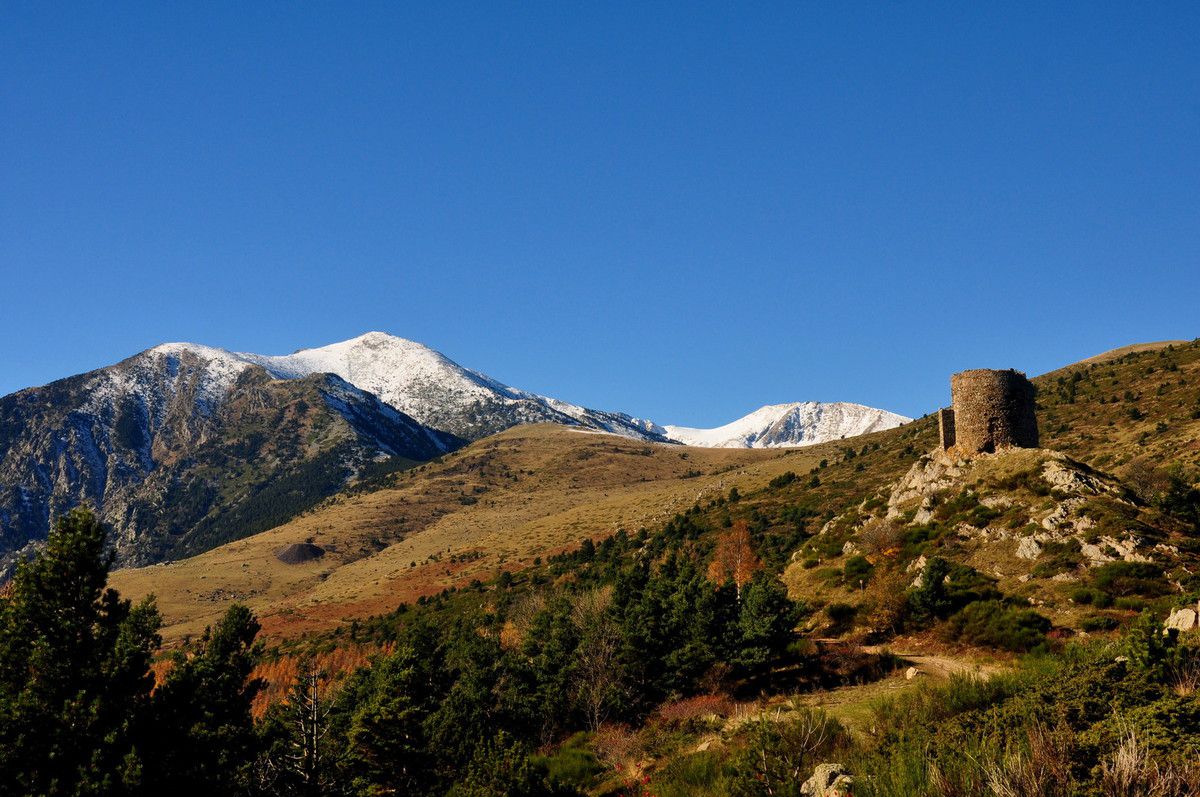
Starting from the Col de la Descargue (1,393m), this hike climbs to the Tour de Batère. Once at the top, the view is simply magnificent.
The return goes via the Col de la Cirère (1,731m) then via the Batère refuge before returning to the starting point.

Already more than 200,000 users!
Uphill
356m
Highest point
1733m
Downhill
356m
Lowest point
1391m
Route type
Loop
Download the map on your smartphone to save battery and rest assured to always keep access to the route, even without signal.
Includes IGN France and Swisstopo.
I indicate whether dogs are allowed or prohibited on this trail
From May to October
0 ratings
Also enjoy:

Already more than 200,000 users!