Uphill
277m
Length
6km
Duration
2h30min
Elev gain
277m
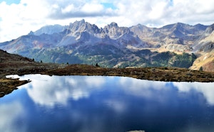
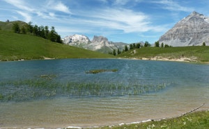
Here is a family hike offering grandiose landscapes, ideal for a picnic by the lake. It is often possible to observe marmots there.

Already more than 200,000 users!
Uphill
277m
Highest point
2544m
Downhill
277m
Lowest point
2396m
Route type
There and back
Download the map on your smartphone to save battery and rest assured to always keep access to the route, even without signal.
Includes IGN France and Swisstopo.
I indicate whether dogs are allowed or prohibited on this trail
From June to September
2 ratings
Also enjoy:

Already more than 200,000 users!